FAA Selects New Unmanned Aircraft Executives

FAA-Puma1

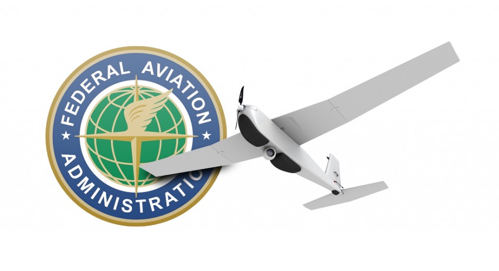
The Federal Aviation Administration (FAA) has selected Marke “Hoot” Gibson and Earl Lawrence for two executive-level positions that will guide the agency’s approach to safe, timely and efficient integration of unmanned aircraft systems (UAS) into U.S. airspace.

Hoot Gibson will become the Senior Advisor on UAS Integration, a position established to focus on external outreach and education, inter-agency initiatives and an enterprise-level approach to FAA management of UAS integration efforts.  He will report directly to the FAA Deputy Administrator.

Gibson previously served as Executive Director of the NextGen Institute, which provides professional services to the UAS Joint Program Development Office. He has also owned his own aviation consulting firm, and held numerous senior command and staff positions  during a 33-year U.S. Air Force career.

Earl Lawrence will become the Director of the UAS Integration Office within the FAA’s Aviation Safety organization. He will lead the FAA’s efforts to safely and effectively integrate UAS into the nation’s airspace.

During almost five years as Director of the FAA Small Airplane Directorate, Lawrence was responsible for 17 aircraft certification and manufacturing district offices in 21 states from Alaska to Florida. Before coming to the agency in 2010, he had been Vice President for Industry & Regulatory Affairs at the Experimental Aircraft Association since 1994.

Both executives will assume their positions later this month.

For more information on the FAA and UAS, go to http://www.faa.gov/uas.

– See more at: https://www.sensorsandsystems.com/news/top-stories/corporate-news/36915-faa-selects-new-unmanned-aircraft-executives.html#sthash.nI1ypwlc.dpuf

Who’ll keep track of all those drones in flight?

Drone traffic control systems mature

With the increased proliferation of smaller aircraft, or hobby drones, that are capable of flying under traditional radar, more unmanned aerial systems will be crowding the skies — and existing air traffic control systems won’t be able to track them.  NASA and the Federal Aviation Administration have begun working with several partners in both the public and private sector to integrate and monitor drones in the airspace.

As one of the big players in the integration of drones into the national airspace, NASA has provided research and prototype methods for UAS traffic management systems, or UTMs, which would monitor drones vis-à-vis the traffic system established for traditional airline transportation.

Lockheed Martin has also developed a UTM.  Mike Glasgow, who is the firm’s aviation services chief architect, told GCN that  Lockheed UTM aims to provide UAS pilots with a flight service similar to that used by commercial and private pilots.  Based on the flight services framework, it would “allow UAS operators to report where they are operating and [make] that data available to pilots and other airspace users.”

Lockheed’s UTM works with those government and commercial drones that have received special exemptions from the FAA to fly.  First deployed in January, Lockheed’s UTM allows UAS operators to report where they will be operating. It then alerts other general aviation pilots in the area that these drones will be flying. Eventually, Lockheed wants to create a system in which pilots file flight plans and integrate an Adverse Condition Alerting Service that would send out emails or alerts with potential changes in flight plans or in flight paths.

Commercial use of drones is currently banned by the FAA unless the agency grants a special exception.  But drones weighing less than 55 pounds can be considered “model aircraft” under the law — hobbyists my freely pilot such devices so long as they keep the drone in sight, fly no higher than 500 feet and stay at least five miles away from airports. These hobbyists are not required to file flight plans or NOTAMs.  Glasgow, who is also a Lockheed Martin fellow, said Lockheed’s system was designed to be used by virtually anyone, but noted the problems associated with operators who can fly virtually without oversight.

NASA’s UTM prototypes will be rolled out under four builds, or phases, between August 2015 and March 2019.  The first build, the agency said, “will create, analyze and manage trajectories and constraints that enable operations by an interactive system. The focus will be on geo-fencing, altitude ‘rules of the road’ and scheduling of vehicle trajectories.”  The first build focuses on rural operations that include operation

According to Glasgow, the fundamental difference between Lockheed’s efforts and NASA’s is that Lockheed is “focused on deploying operational capabilities as quickly as possible as they become ready,” while NASA is working on a multiyear effort to prototype.  “[NASA’s] building a UAS traffic management prototype, basically vet concepts and show how it could work,” he said, boiling down the difference as research vs. deployed operational capabilities.

NASA and the FAA have also partnered with others in industry to find ways to monitor thousands of new objects flying in the busiest and safest airspace.

For example, Amazon has proposed a segregated airspace below 500 feet, which “will buffer sUAS [small UAS] operations from current aviation operations. It will also buffer lesser-equipped vehicles from highly-equipped vehicles able to safely perform BLOS [beyond line of sight] missions.”  The plan segregates the airspace outlining certain aircraft to operate in airspace below 200 feet, between 200 and 400 feet and between 400 and 500 feet.

Another aspect of monitoring UASs is the ability to establish geofences, or electronic barriers that prevent aircraft from flying into a particular region.  At a recent NASA UTM conference, proposers demonstrated how users approved for a flight plan must enter a valid geofence into the UTM system prior to take-off.  While there are several software programs and add-ons that are capable of geofencing, these tools are valid only for users that are required to file flight plans, which excludes model aircraft users.  Additionally, some experts have warned that geofence software could be susceptible to hackers.

About the Author

Mark Pomerleau is an editorial fellow with Defense Systems and GCN.

http://gcn.com/articles/2015/08/31/drones-utm.aspx

B4UFLY Smartphone App

thumb1

Beta test now underway

B4UFLY is an easy-to-use smartphone app that helps unmanned aircraft operators determine whether there are any restrictions or requirements in effect at the location where they want to fly.
On August 28, 2015, the FAA released B4UFLY to approximately 1,000 beta testers, including members of industry, government, and the public.

This limited beta test is expected to run for several months, after which the FAA plans to make a final version of B4UFLY available for the general public. The beta version of the app is for iOS devices only, but the FAA intends to release a future version for both iOS and Android devices.
Key features of the B4UFLY app include:

A clear “status” indicator that immediately informs the operator about their current or planned location. For example, it shows flying in the Special Flight Rules Area around Washington, DC is prohibited
Information on the parameters that drive the status indicator

A “Planner Mode” for future flights in different locations

Informative, interactive maps with filtering options

Links to other FAA UAS resources and regulatory information

For more information, view the B4UFLY Q&A(PDF).

http://www.suasnews.com/2015/08/38175/b4ufly-smartphone-app/

https://www.faa.gov/uas/b4ufly/media/UAS_B4UFLY_QandA.pdf


Sony’s quadcopter takes smartphone tech to the skies


Aerosense droneAerosense drone

A drone developed by Sony’s unmanned aerial vehicle venture Aerosense is seen in a promo image. The startup wil target enterprise users in everything from farming to construction from 2016. Credit: Aerosense
Equipped with a high-speed data transfer module, the quadcopter uses Sony’s lens-style camera to image construction sites and farms.

By Tim Hornyak

IDG News Service | Aug 24, 2015

Sony is gunning for a slice of the growing drone market, showing off newly developed unmanned aerial vehicles (UAVs) from its just-launched drone venture, Aerosense.

In addition to the vertical takeoff and landing (VTOL) craft hinted at last month, Aerosense on Monday exhibited a quadcopter that makes use of Sony’s lens-type camera, the QX30.

The camera, which resembles a lens for a digital single-lens reflex (DSLR) camera and can link to smartphones, is attached to the belly of the quadcopter, where it can take high-resolution images.

Designed for use in urban areas such as construction zones, the AS-MC01-P quadcopter weighs about 3 kilograms (6.6 pounds) and can fly for about 15 to 20 minutes on a battery charge.

It can operate autonomously, flying within a preset zone, and is equipped with GPS, Wi-Fi and an inertial navigation system. It also has a high-speed data transfer module that uses Sony’s TransferJet technology.

In a presentation in Tokyo, Aerosense showed how photography from the camera can be turned into 3D imagery, showing, for instance, the volumes of piles of gravel at a construction site.

The venture’s other craft, the AS-DT01-E winged VTOL drone, has a rotor system that allows it to fly like a helicopter or a plane. The advantage of the winged format is that it can fly at much higher speeds than most non-military drones — up to 170 kilometers per hour (106 miles/hour) compared to high-speed quadcopters that fly at 75 kph (47 mph).

Weighing 7kg (15 pounds), it can carry a 3kg payload (6.6 pounds) and operate for at least two hours on a battery charge.

Aerosense will target enterprise customers when it begins to offer drones for monitoring, surveying and inspection next year.

Potential applications include photographing agricultural land, mining sites and mountainous areas to check for damage after a storm.

Sony wants to use its smartphone technologies such as cameras and networking know-how to give Aerosense an edge. Sony Mobile Communications owns just over 50% of the venture, with the rest in the hands of Tokyo robotics firm ZMP, which set up a robot taxi company earlier this year along with mobile gaming giant DeNA.

Sony also has robotics resources that it is putting into the drone business. Aerosense’s CTO is Kotaro Sabe, who worked on the electronics maker’s Aibo robot dog and Qrio humanoid robot, both of which were shelved when Sony shut down its entertainment robot business about 10 years ago.

Sony’s Xperia smartphones have been struggling in Japan and overseas against the more popular Apple iPhone as well as Android rivals.

“It’s possible that future growth in smartphones could be limited, so we have to engage and invest in new business opportunities,” said Hiroki Totoki, head of Sony Mobile Communications.


http://www.computerworld.com/article/2975016/emerging-technology/sonys-quadcopter-takes-its-smartphone-tech-to-the-skies.html

The drones of tomorrow

Unmanned aerial vehicles need enabling regulations

Business Standard Editorial Comment  |  New Delhi  August 22, 2015 Last Updated at 21:40 IST

One of the challenges of wedding photography is videotaping the procession as it starts its journey from the groom’s house. However, of late an increasingly common solution has been the deployment of a camera-drone. It allows for unusual and interesting angles of coverage. are also covering fashion shows, political rallies and concerts. And there is much talk of using them to deliver pizza. Clearly, drones, or (UAVs), are now well and truly part of everyday life. The cost of owning and operating one is roughly equivalent to a mobile phone. Many UAV models are available off the shelf, with prices between Rs 3,000 and Rs 1.5 lakh. Of course, the military and security uses are well-known. The Indian security establishment is said to deploy more types of drones – at least 50 different models – than any nation other than the USA. The police use for monitoring religious processions and gatherings such as those during Ganesh Chaturthi, Ramzan, the Kumbh Mela and so on. The deployment of UAVs which can spray tear gas on rioters is also under consideration.

But UAVs can also perform a very wide range of civilian tasks. They are used for mapping and surveying, and gathering meteorological, environmental and oceanographic data. Spraying of crops with pesticides and fertilisers was pioneered by Japanese farmers. UAVs are also deployed for monitoring activity in forests, and in disaster relief. They can be used to deliver food and medicine across difficult terrain, or to provide Internet connectivity. Given increasingly sophisticated technology and human ingenuity, the sky is literally the limit when it comes to figuring out new usages for drones. There is a domestic industry with at least 25 local UAV manufacturers, and many start-ups offering software and associated technological products and services. There is even a lobby: the Unmanned Systems Association of India.

Obviously, there are concerns about safety, security and privacy. Accidents could happen, or UAVs could be used deliberately to cause harm in many ways, or to spy on people. But blanket bans would be impossible to enforce, apart from being retrogressive in spirit. What is needed are modern regulations; but there are no regulations governing the use of UAVs, either by government agencies, or by private citizens and companies. As of now, the civilian UAV sector operates under the constraint of almost absurd regulations, which were released in October 2014. In theory, every civilian user is supposed to seek permission for every UAV flight from both the (DGCA), and the Ministry of Home Affairs. In practice, these regulations are unsurprisingly, often ignored. It is easier to “request” local police to look the other way. The security implications are terrifying.

The is said to be formulating draft regulations for civilians, based on the regulations of the American (FAA). The licenses civilian use of UAVs weighing less than 25 kg, which can be flown at heights of up to 150 metres (or 492 feet) and at speeds of up to 160 kilometres an hour. Flights are restricted to line-of-sight. Commercial operators may apply for renewable permits. No-fly zones are also defined. But even the FAA regulations have been criticised as constricting. UAVs can fly much higher, at far greater speeds, and safely out of line-of-sight. But if the DGCA does release a draft, the details could be thrashed out via the usual consultation process. The regulations would have to be subject to review as technology improves. It also behoves the government to set transparent, clearly defined limits on the use of UAVs by its own agencies, given the privacy implications. UAVs provide classic examples of technology which can be both disruptive and enabling. There are enormous potential benefits but there are also obvious dangers. Regulation is absolutely necessary but it must be flexible and guided by common sense.


http://www.business-standard.com/article/opinion/the-drones-of-tomorrow-115082200821_1.html

Philadelphia to be no-drone zone for pope’s visit

Philadelphia to be no-drone zone for pope's visit

Philadelphia will be a no-drone zone when Pope Francis is in town.

The FAA says Wednesday it’s banning the unmanned aircraft from city airspace during the Sept. 26-27 visit.

An agency advisory says model airplanes, gliders and hot air balloons are also being barred, along with planes towing advertising banners.

Don’t think about parachuting in or flying a crop duster, either.

Law enforcement, first responders and the news media are required to apply for airspace clearance at least a week before Francis arrives.

The Department of Homeland Security requested the restrictions.

The FAA says they’re designed to ensure safety while providing as much airspace access as possible.

The agency says the restrictions could change with little or no notice.

http://6abc.com/religion/philadelphia-to-be-no-drone-zone-for-popes-visit/948993/

Can Taiwan create innovative companies like DJI?

A DJI booth at the 8th International Model Exhibition in Shenzhen, April 3, 2014. (File photo/CFP)

A DJI booth at the 8th International Model Exhibition in Shenzhen, April 3, 2014. (File photo/CFP)

An unmanned aerial vehicle (UAV) guided by a Chinese tourist crashed into the Taipei 101 skyscraper last month, provoking national security concerns.

In fact, there have been numerous reports of drone incidents around the world since last year. Earlier this year, a small drone crashed in a White House garden, spurring calls for tighter regulations of the technology because it could be abused by terrorists.

In April, a drone bearing trace amounts of radioactive cesium was found on the helicopter pad on the roof of the Japanese prime minister’s office.

The use of drones has also been frequently reported in war-plagued Nigeria, Syria and Pakistan.

Thanks to breakthrough technology, drones can take off and land even in highly sensitive areas and could spur the next phase of the logistics revolution.

Notably, all of the UAVs used are made by Shenzhen-based DJI Innovations, which specializes in the development of remote-control quad-copters.

DJI ranked third on the list of the world’s top 10 most innovative companies of 2015 in the consumer electronics field, behind internet giant Google and electric-car manufacturer Tesla.

DJI has also been regarded by some as the only technology company other than Apple that can dictate world trends.

Currently, DJI controls 80% of the global market for civilian drones.

Founded in 2006 by Wang Tao shortly after he graduated from Hong Kong University of Science and Technology with the support of a research team from the university, DJI is the worldwide leader in UAV flight control systems.

The company offers a wide range of products and services designed to aid in the use of unmanned aerial systems, both professional systems and those used by hobbyists.

Wang was originally keen to set up his first start-up in Hong Kong, but his efforts went nowhere partly because of a lack of funding and a lack of government support.

Wang was forced to give up Hong Kong as his first choice for his start-up and later launched DJI in Shenzhen. Today, Shenzhen is not only the home of DJI but also a hub for many other key technology businesses because it hosts several individual supply chains specific to producers there.

In 2010, however, the university of Hong Kong invested HK$2 million (US$258,000) in the company, showing the close relations between the two parties.

It is also hoped Taiwan can create innovative start-ups like DJI by offering financial support and relaxing regulations governing the enrollment of its own students as well as Chinese students in Taiwan’s universities to allow them to innovate and contribute to Taiwan’s economy after graduation.


http://www.wantchinatimes.com/news-subclass-cnt.aspx?id=20150822000075&cid=170

Congressman Polis Honors UAS Professionals for Startup Day Across America

congressmanpolis

Broomfield, Colorado: In honor of Startup Day across America, Congressman Jared Polis, Co-Chair of the Congressional Caucus on Innovation and Entrepreneurship, Broomfield’s Mayor Pro-Tem Greg Stokes, City Council Members and city staff honored UAS Professionals as a startup company leading the UAS industry in Colorado. UAS Professionals is a FAA approved drone operator headquartered in Broomfield that provides support and training to individuals and businesses wanting to utilize dronetechnology. In addition, they have founded a non-profit organization, Coalition of UAS Professionals, to represent the voice of the small business operator. With no membership fees, the nonprofit provides updates of all pending and passed legislation affecting the UAS industry. In addition, the Coalition provides a forum for members to share ideas and a means to help shape the future of this burgeoning industry.

Startup Day Across America was founded by Reps. Jared Polis (D-CO) and Darrell Issa (R-CA) in 2013. The day is designed to recognize the innovation created by startups across the country and connect elected officials with startups in their communities so they can learn about the challenges new companies face. Startups add enormous value to our local and national economies, and they are responsible for a majority of the net job growth in the U.S. They will ultimately be the engine that drives the tremendous economic impact UAS is poised to achieve.

At the event, Congressman Polis, Mayor Pro-Tem Greg Stokes, and budding entrepreneur, Jack Bonneau (9 years old) faced off in a drone flying completion. Following a bit of tutelage from UAS Professionals, each took to the “gauntlet” – a UAV obstacle course requiring precision flying. Scored by 3 volunteer judges, the competition was very tight, but in the end, young Jack edged out the Congressman and Mayor Pro-Tem receiving perfect scores of 10-10-10 after landing his drone unassisted.

“Today’s garage startups will be employing thousands of employees in the next 5 to 10 years,” said Congressman Polis. “Supporting Startup Day Across America is a highlight every year for the City and County of Broomfield, as we have so many small businesses that contribute everyday to our thriving economy,” expressed Broomfield Mayor Pro-Tem Greg Stokes. “We know how important it is to support startups like UAS Professionals who, in turn, support local startup businesses themselves and jobs. It was a very fun day!”

UAS Professionals offers a full service solution to the unmanned aerial systems (UAS) Industry. The company provides a range of training solutions, from the first-time hobbyist who wants to master the skills of flying drones safely to the commercial operator who needs certification in areas such as infrared imaging or forensic aerial photography. UAS Professionals also provides business support to startups, including helping them obtain legal approval to operate commercially. As one of the first companies in the state of Colorado to receive authorization from the FAA, UAS Professionals conducts mission operations for organizations that need aerial data collection – ranging from photography, videography and GIS mapping to multispectral analysis.

“We are honored that Congressman Polis is recognizing UAS Professionals as a leading startup company in the drone industry.  The potential of this technology is tremendous – analysts estimate that the economic impact just for Colorado over the next 18 months will exceed $232 million with the creation of 1,190 new jobs.  But the only way to make this a reality is to go above and beyond public expectations, driving the industry to operate at the utmost levels of safety and professionalism,” said Nathan Ruff, Chief Operating Officer, UAS Professionals.

About UAS Professionals:

UAS Professionals provides aerial data collection solutions, drone training, and small businesses assistance filing 333 exemption waivers with the FAA so they can conduct commercial operations legally. UAS Professionals are the founders of a 501(c)3 non-profit organization The Coalition of UAS Professionals, which provides education and assistance to the small business operators who will ultimately be the economic engine powering the drone industry. For more information on UAS Professionals, please visit www.UASPI.com, email Nathan@uaspi.com or call 720-330-8320 x6.