Drones give law enforcement a new edge, but raise concerns

thomasjones

Michaelle Bond, Inquirer Staff Writer

As the camera attached to its underbelly snapped pictures, the drone glided a few hundred feet above the quiet, tree-lined suburban streets of North Coventry Township.

It was tracing the path of a killer, investigators say.

Chester County prosecutors are hoping the images captured by the unmanned device, driven by four propellers and weighing less than a half-gallon of milk, will help prove that a man arrested last month carefully planned his fatal attack on a rival who was involved with his ex-girlfriend.

As an alternative to costly helicopter reconnaissance flights, the county says, the craft that it bought last fall for $1,800 is saving taxpayers thousands of dollars.

Drones such as this one are becoming ever more popular across the nation for investigative and other purposes, with industry officials projecting that 20,000 will be purchased annually by public-safety agencies by 2025.

They also have stoked privacy concerns.

So far, 26 states have enacted drone-related privacy laws, and all but a handful of states have at least considered such laws, according to the National Conference of State Legislatures.

The New Jersey Assembly overwhelmingly passed a tough drone-related privacy-protection law in May that awaits Senate action.

On Friday, Pennsylvania state Sen. Mike Folmer (R., Lebanon) introduced a bill that would ban government agencies from flying drones without a warrant, except in emergencies, for two years to give lawmakers time to catch up.

“My concern is technology is growing faster than our ability to make sure people’s constitutional rights are being protected,” Folmer.

In Chester County three police departments, in Upper Uwchlan and New Garden Townships and Phoenixville Borough, either have or plan to buy drones for search-and-rescue, arson, and accident investigations.

Nationwide, 609 government agencies – including those involved in law enforcement, firefighting, border patrol, military training, disaster relief, and search and rescue – received permission from the Federal Aviation Administration last year to use unmanned aircraft systems, compared with 423 in 2013, and 146 in 2009.

The International Association of Chiefs of Police has recommended guidelines for law enforcement agencies using unmanned aircraft.

East Goshen Township passed an ordinance to restrict drone use in March.

The Philadelphia Police Department does not use nor plans to use drones in the near future, a spokesperson said. The New Jersey State Police and county prosecutors’ offices in the region were unaware of any police agencies using drones.

Police officials say the devices can keep officers out of dangerous situations and cover more ground quickly – say, in the case of a missing child or an armed suspect on the run, especially in rural areas.

Chester County officials said they will use drones for specific missions, not everyday surveillance, and have safeguards in place, such as requiring that supervisors sign off on any use of the aircraft.

In the case of the man accused of killing a rival, prosecutors plan to use drone images to build a court exhibit showing the defendant’s comings and goings before and after the crime.

Drones have been associated with military uses, and thus have stoked fears that government agencies will use them to spy on private lives.

County officials are reluctant even to use the word “drone,” preferring to call their aircraft a “quadcopter.”

” ‘Drone’ has a lot of connotations behind it,” said Terence Farrell, chair of the county commissioners. “This is used strictly to help people. Drones sometimes are not.”

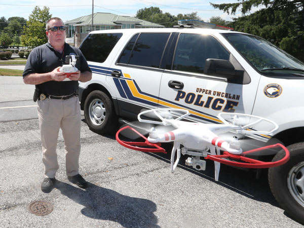
The Upper Uwchlan Township Police Department has been using the drone it bought earlier this year to search for fugitives, to monitor traffic, and to take aerial photographs of motor-vehicle accidents.

“The problem with drones isn’t that there aren’t beneficial uses for them,” said Chad Marlow, advocacy and policy counsel at the American Civil Liberties Union. “There are potentials for abuses if police use these stealthy machines to run around warrant requirements.”

Like wiretapping equipment or any other police gear, the technology can be misused, police acknowledge.

The New Garden and Phoenixville police have asked the FAA for permission to fly drones, and departments are drafting policies to govern their use.

John DeMarco, Upper Uwchlan police chief, said that, so far, residents have not expressed concerns.

The Phoenixville Borough Council is not convinced that its police department needs a drone or the threat of liability it could bring, said Chris Bauers, a councilman.

Last month the council told its solicitor to review the police department’s policies on drones before members decide whether to allow officers to proceed.

Officers expect a decision within the next couple of months and remain hopeful that their policies will satisfy residents.

“To get the community behind us and to get them to trust us,” Chief William Mossman said, “we’re going to have to limit ourselves.”
Read more at http://www.philly.com/philly/news/20150810_Drones_give_law_enforcement_a_new_edge__but_raise_concerns.html#rvwkjfvKgiKr8bQ6.99
Colorado’s ready-to-fly dronemakers stalled by MIA federal rules

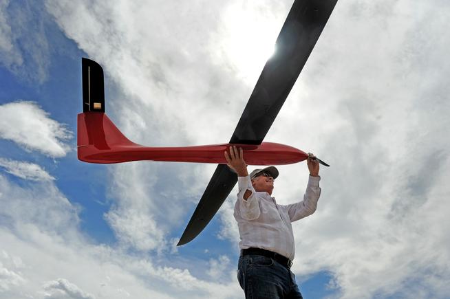
Drones are being used in Colorado with FAA expemption

By Laura Keeney  The Denver Post

Fifteen of the first 500 FAA exemptions permitting commercial drones to fly were granted in Colorado.

But enabling those and other waiting businesses to spur an estimated $232 million in economic impact — and create more than 1,190 jobs — in Colorado by 2017 hinges on long-delayed rules based on a 1946 U.S. Supreme Court case filed by a poultry farmer.

Yes, that’s right. Regulation of high-tech drones in the U.S. starts with chickens.

Under current aviation law, aircraft must fly no lower than 1,000 feet above congested population areas, and at least 500 feet above less-populated areas.

But there are no permanent regulations for commercial unmanned aircraft systems, or drones. The vehicles are illegal to fly in the national air space without a Federal Aviation Administration permit called a Section 333 Exemption. The permit allows drones to fly commercially as long as they fly in daylight, no higher than 500 feet and within the operator’s line of sight.

The delay in deploying regulations that have been discussed for more than five years is frustrating companies in Colorado, and elsewhere, that use drones for such diverse tasks as delivering packages, and surveying real estate, oil and gas wells and farm fields .

http://www.denverpost.com/business/ci_28612999/mia-federal-rules-stall-colorados-ready-fly-dronemakers

Kathmandu – 3D views before and after the earthquake

earthquakedamage

– Natalia

Earlier this month, we noticed several different scans of Durbar Square in Kathmandu, that was hit by the large earthquake in spring 2015. In an ongoing initiative to document heritage sites, we invited the two teams to digitally reconstruct it in 3D, based on imagery before and after. Several organizations and companies contributed their knowledge and platforms to the project, which led to the development of new ways to document, store and present endangered or lost cultural heritage.

The German company nFrames created a 3D model from imagery of the site before the earthquake using software developments and their experience in 3D surface reconstruction from images. The images were acquired by the national aeronautics and space research center of Germany from Berlin using a special camera system called MACS from a high altitude. The 3D model after the earthquake was made by the company Drones Imaging from photos taken by an unmanned drone (UAS or RPAS) from close range. The alignment of both datasets over each other was done using the Sketchfab Viewer API enabling the documentation and visualization of the damage.


<iframe width=”640″ height=”480″ src=”https://sketchfab.com/models/e21d746815b248b1b566b12aa7fa596e/embed” frameborder=”0″ allowfullscreen mozallowfullscreen=”true” webkitallowfullscreen=”true” onmousewheel=””></iframe>

<p style=”font-size: 13px; font-weight: normal; margin: 5px; color: #4A4A4A;”>
<a href=”https://sketchfab.com/models/e21d746815b248b1b566b12aa7fa596e?utm_source=oembed&utm_medium=embed&utm_campaign=e21d746815b248b1b566b12aa7fa596e” target=”_blank” style=”font-weight: bold; color: #1CAAD9;”>Kathmandu</a>
by <a href=”https://sketchfab.com/nframes?utm_source=oembed&utm_medium=embed&utm_campaign=e21d746815b248b1b566b12aa7fa596e” target=”_blank” style=”font-weight: bold; color: #1CAAD9;”>nFrames</a>
on <a href=”https://sketchfab.com?utm_source=oembed&utm_medium=embed&utm_campaign=e21d746815b248b1b566b12aa7fa596e” target=”_blank” style=”font-weight: bold; color: #1CAAD9;”>Sketchfab</a>
</p>

Kathmandu by nFrames on Sketchfab

This technology contributes to digitally preserving damaged cultural heritage while making it available for everyone to view. More before and after shots are on Drones Imaging blog.

A larger initiative, Project Mosul provides a platform collecting 3D models of art and artifacts in danger due to political conflicts or natural hazards, relying on crowdsourced images and data. By visualizing lost landmarks, we can preserve their memory and possibly lead to the creation of an entirely interactive online museum. In another sense, we hope reconstructions like this could also help people rebuild the Durbar Square area of Kathmandu.

Together, we are working on new ways of digital restoration and curation of lost heritage. It’s an inspiring use of the technology and we hope to see more!

Homeland Security Issues Warning About Drones


Homeland Security Issues Warning About Drones

Once again the subject of the potentiality of drones being used by terrorists has hit the news, this time by CBS that learned the Dept. of Homeland Security sent out an intelligence assessment to law enforcement agencies across the US regarding drones being used as weapons.

The bulletin warned that Unmanned Aircraft Systems or UAS, could be used by terrorists in attacks.

This comes to no surprise, however to the public that has increasingly seen drones become a nuisance and menace. Irresponsible operators of the drones, including news companies, kids, adults, and recreational people, are commonly now the subject of news stories. Drones can be easily modified to carry such things as cameras and even firearms. Aficionados of the technology come up with ingenious ways to “mod” these devises and many show up on YouTube videos.

The demonstrations of what these drones can do is frightening. Several videos show modded drones firing with astonishing accuracy, paint balls and real bullets. Armed with such a device, criminals could wreak havoc by sending several of the armed drones into crowded places and firing upon innocent citizens. The drones can carry a good amount of ammunition and can easily be recalled to equip more.

That being said, the federal officials see a rising trend in the use of UAS devices. Terrorists have a plethora of targets that they could attack and the drones are not that expensive and if destroyed, others can replace it. A fleet of such devices armed with bullets or chemical or viral payloads would be difficult to detect and stop before they let loose their hazardous cargo.

The bulletin points to the assessment that the majority of UAS encounters are benign but the potential for security vulnerabilities is alarming. This bulletin is considered unusual but none the less important.

The issue here is that any new technology can be used for wrongdoing. When new devices emerge, there are those with nothing less than ill intent who will use such technologies for their nefarious actions.

At present drug dealers use drones to deliver significant amounts of drugs, survey areas for police and transfer money. It’s a clear sign that at some point, some sinister force or some mentally deranged persons will use drones maliciously. It’s not a matter of ‘if’ anymore, it’s a matter of ‘when’. So far we’ve seen drones interfere with rescue and police operations, drones almost hitting planes, drones crashing into people and property. Just one drone armed with an explosive could cause misery and mayhem and there would be no way to stop them.

This calls for countermeasures where sensitive buildings, cities, towns, need a radar type detection system for drones. To be able to track them. Perhaps issuing official licenses for the operation of such devices would be sound.

The other problem is the technology of drones is accelerating. Aficionados are working diligently to make smaller, faster, stealthier, and noiseless drones. So are the big drone companies. Let us not forget drones for traveling underwater too. Bigger drones that can carry heavier payloads are in the works and other variations on a theme.

It looks like if drones continue to become a menace, they’ll be licensed or banned. If that comes to pass the public will issue an outcry unless a drone attack is so devastating that the public becomes in fear of them.

We’ll just have to wait and see what happens next.

Texas Body Farm Researchers Use Corpses to Solve Crimes

http://www.texastribune.org/2015/07/25/texas-body-farm-research-uses-corpses-solve-crimes/


texasbody

SAN MARCOS — A drone flew over the sprawling hills of Freeman Ranch about two years ago, capturing a monochromatic photograph. The gray landscape was grass and dirt and the white spots denoted excessive vegetation. The black flecks were decomposing corpses.

It was exactly the picture that Daniel Wescott, a forensic anthropologist, and Gene Robinson, the owner of a search and rescue organization, were looking for to prove their suspicions that a plane equipped with the right technology could locate the dead.

“We just had one of those eureka moments,” said Robinson, who is based in Wimberley. “We can put these two things together and suddenly we have a forensic tool.”

The ranch is home to about 50 human corpses donated to the Forensic Anthropology Center at Texas State University, which uses them to conduct research that can help medical examiners identify bodies, rescuers find missing persons and law enforcement solve crimes.

Dead bodies are peppered across Texas State’s gated 26 acres on Freeman Ranch. Some are completely decayed down to bones loosely covered by tan, leathery skin, while more recent arrivals resemble the living except for the swollen flesh and colonies of flies laying eggs in facial orifices.

Wescott is the director of the center, known informally as a “body farm.” He helps design many of the research projects in the hopes that by controlling the conditions the body decomposes in — and knowing the biological facts of the person who died — the studies can offer insight on murders or unexplained deaths when much less information is available.

The drone flights are part of an ongoing study using near infrared imaging to detect corpses above and below the ground that are often not visible to the naked eye. The technology can also spot locations where a corpse was previously buried for up to two years after it has been removed.

“The search for clandestine bodies is a very time-consuming ordeal,” Wescott said. “Even then, a lot of times you can walk right by them and not realize that they’re there.”

Near infrared imaging picks up reflectance; as a corpse decays it releases carbon and nitrogen into the soil, decreasing the amount of light the soil reflects. At first, the influx of chemicals kills plants, but as it disperses into the area around the body it turns into a fertilizer causing extra vegetation, which reflects a lot of light.

The two extremes show up as black and white on the mostly gray near infrared imaging, giving anyone looking for a body, Robinson said, double the chances of finding of it.

The Texas State labs, which opened in 2008, are constantly churning out research. The placement and conditions of the bodies are purposeful; many are protected by metal-pole cages, but those that aren’t resemble a collection of scattered bones, pillaged by vultures and raccoons. Corpses are above and below ground as well as in both the sun and shade to compare the decay of each. Some bodies are wrapped tightly in tarp, part of a new study that will look at the rate of decay for a common modus operandi of disposal for murders.

The center grabbed national attention recently when it collected the remains of 80 undocumented immigrants who died after crossing the border. Found in a mass grave in Brooks County, the bodies were buried haphazardly, some covered only by trash bags and shopping bags.

Kate Spradley, a researcher and associate professor of anthropology at Texas State, leads a team working to identify the immigrants and send their remains home. The work is slow, and so far the team has confirmed three identities.

NZ:- New drone rules ‘criminalise a hobby’

http://www.suasnews.com/2015/07/37456/nz-new-drone-rules-criminalise-a-hobby/

bruceinthewoods

BRUCE SIMPSON

As a young boy in the 1960s I spent many hours down at the local park or schoolyard, flying my carefully hand-built model aircraft.

It was such a buzz to see them take to the air – even if they usually did crash just moments later.

Over the 50 years or so since those halcyon days of my childhood, I have continued to enjoy a hobby that exercises the body and the mind. Far better to be outdoors enjoying the sunshine and summer breezes than spending hours in front of the dim glow of a computer screen – as so many of today’s kids are given to doing.

In my entire 55 years of flying model aircraft, I have never once injured anyone nor damaged anyone else’s property – and that’s despite being a very active participant of the hobby. Most of the time I was flying the only rule was ‘use common sense’ – and obviously this has worked pretty well for me and the thousands of other Kiwis that have enjoyed this innocent pastime. I have searched high and low but can not find any records of anyone dying or harming another in New Zealand as a result of this hobby and it seems that the only injuries sustained seem to be related to the operator’s own body and small propellers – sometimes painful but not fatal.

So it was with great sadness, that I read through the CAA’s new regulations for the operation of radio controlled flying models and drones – now collectively called “remotely-piloted aircraft”. How tragic it is that in one fell swoop of the regulator’s pen, those who fly these craft for pleasure and relaxation are now treated like criminals and have effectively been stripped of the rights they’ve enjoyed for so long – despite the fact that this hobby has an outstanding safety record?

No longer can a father and his young boy just walk down to the local schoolyard or park to fly the cheap toy model purchased online from China or carefully hand-crafted over a long series of winter evenings. Although these craft may weigh just a few tens of grams, the new regulations consider them to be every bit as menacing, risky and dangerous as the much larger professional drones used by commercial operators.

If you or your children fly their tiny toys anywhere, without first obtaining the permission of the property owner over which they will briefly soar, then a $5000 fine is in the offing.

What’s more, even if the local council sets aside a small park or reserve in which you have permission to fly, you must also seek the permission of anyone else who is using that area or who enters that area – lest you face another possible $5000 fine.

This leaves me asking – what has gone wrong with this country?

Why are we treating children and responsible adults like enemies of the state, threatening them with huge fines for doing nothing more than that which they’ve been doing for decades, in complete safety and in harmony with the world around them.

The ironies are abundant and quite worrying.

I can walk across any piece of land in New Zealand without fear of being fined or imprisoned – at worst I’ll be asked to leave and possibly trespassed. If I have a full-sized aircraft, I can fly it across almost any piece of land in New Zealand with impunity. However, if my child flies his 20-gram toy over the same land without gaining the expressed prior permission of the landowner, he has committed an offence under CAA’s new regulations; an offence of such magnitude that it warrants a $5,000 fine. How does that work exactly?

CAA tell us that these new regulations are risk-based and that the more risky the operation, the tougher the regulations and penalties. So please explain to me how it is somehow less risky for a commercial operator to fly his very large, very heavy, potentially lethal drone over my head without my permission – than it is for my child to do the same with his feather-weight 20 gramme toy? (pictured)

It would appear that CAA’s definition of risk is significantly different from my own, or that of anyone else I have spoken with.

Clearly CAA failed to consult with credible independent experts before conjuring up these new regulations. For example – they stand to have a decidedly negative impact on our tourism industry.

In most countries around the world, it is legal to fly recreational drones in public places – so long as you adhere to a few commonsense rules. Sadly for us, it is now illegal for anyone to fly a drone in a public place without prior consent. In the case of most of NZ’s landscape, obtaining that consent will likely be nigh on impossible for someone who’s only in the country for a few weeks. Already I have heard from a number of regular tourists to New Zealand who have said they will be striking this country from their list of preferred destinations.

Why is this?

Well these are the early-adopters who love NZ’s adventure-tourism attractions. These are the people who have already replaced their 35mm camera and camcorders with a flying camera in the form of a drone. They aren’t satisfied with 8×5 glossy snapshots of their holiday, they want high definition video of all the places they visit – taken from an aerial vantage point. They want to use their drone to get incredible external footage of them whizzing down our ski slopes.

Whilst such things are totally legal in most other countries – try it in New Zealand after August 1st and you could cop one of those $5,000 fines for your troubles.

CAA’s new regulations have clearly made NZ a much less desirable destination for the young, affluent tourist who has money to burn and a yearning for the latest gadgets. What’s more, as drone-based cameras become more commonplace, a greater percentage of our tourist market will opt for more “drone-friendly” countries than NZ.

Does our tourism industry even realise what they’re about to lose? Were they even consulted? I strongly suspect the answer to both questions is a resounding “no”.

So congratulations CAA – you have criminalised a hobby and are twisting a knife in the belly of our adventure tourism industry through your poorly conceived regulations.

Of course if you want to sidestep many of these restrictions, you can simply pay CAA a large fistful of dollars and then have the right to fly pretty much anywhere you want – regardless of the concerns of those below your craft. Yes, somehow, the payment of money is a sure-fire way to reduce risk – or so it would seem.

All I can deduce from this is that we have yet another case where the rights of New Zealanders are being erased and replaced by “privileges” that must be purchased from the appropriate government agency.

August 1st, 2015. A sad day for children and a sad day for the freedoms and rights of Kiwis.

Drones: a force for good when flying in the face of disaster

http://www.theguardian.com/global-development/2015/jul/28/drones-flying-in-the-face-of-disaster-humanitarian-response


Unmanned aircraft can be put to effective use in humanitarian situations, but a code of conduct is needed to make sure they are used safely and efficiently
A drone delivers supplies and medicine to thousands of people seeking dental and medical care at a clinic in the Wise county fairgrounds in Wise, Virginia. The flight was undertaken in part to study how the technology could be used in humanitarian crises around the world.
A drone delivers supplies and medicine to thousands of people seeking dental and medical care at a clinic in the Wise county fairgrounds in Wise, Virginia. The flight was undertaken in part to study how the technology could be used in humanitarian crises around the world. Photograph: Pete Marovich/Getty Images
Guardian Global development is supported by:
About this content

Jennifer Hlad in Washington

Tuesday 28 July 2015 08.42 EDT


After typhoon Haiyan wreaked havoc on the Philippines in 2013, killing more than 6,300 people and destroying farms and villages, several relief groups flew drones over the affected areas to survey the damage, identify blocked roads and find displaced people.

But the drone operators didn’t share the information they gathered with local authorities or other relief organisations, says Patrick Meier, who was in Manila doing humanitarian work with the UN at the time. Many of the drone teams didn’t even know about one another, making their work inefficient and even dangerous.

These problems highlight the need for a code of conduct and best practice for drone use in humanitarian situations, says Meier, who founded the Humanitarian UAV Network to move toward that goal. Meier was one of the speakers at a recent symposium on drones in Washington, which discussed many uses of unmanned aircraft in humanitarian situations but highlighted the need for regulation. Meier says the Humanitarian UAV Network plans to launch a set of guidelines next month that will make sure drone use in humanitarian settings is safe, coordinated and effective.
Nepal’s farmers struggle to overcome terrible legacy of earthquakes
Read more

Though unmanned aircraft are best known for their military uses, smaller drones are becoming popular with photographers and others with a few hundred pounds to spend and a desire for aerial images. In June, police in London seized a drone flying over Wimbledon, two days before the tennis tournament was set to begin. In July, efforts to drop water and retardant on rapidly spreading fires in southern California were stymied by drones hovering over the flames, because of the risk to firefighting aircraft. Also in July, a teenager in Connecticut posted a video of a homemade drone firing a gun in the woods.

But there are many ways drones can be used for good, says Peter Rabley, property rights director for the Omidyar Network, a philanthropic investment firm. Drones can democratise data collection and “help make the world a better, safer place”, he says.

Unmanned aircraft have been used to track Indonesia’s progress rebuilding after the 2004 tsunami, to monitor sporting events in the Netherlands so that injured athletes can get medical attention more quickly, to track weather in Peru, and to rebuild communication networks in Ireland after floods, according to Abi Weaver, director of international services for the American Red Cross. In South America, drones are helping to preserve archaeological sites, simplify the land titling process, and document environmental violations.
Advertisement

Drones also can be used in disaster preparedness: identifying risk areas before a disaster strikes, Weaver says. However, it is critical that residents in any area where drones are being flown are informed and consulted about how and where they will be used.

Secure property rights are the bedrock of property development, but many communities lack the information and documentation required for those rights, according to Janina Mera, a researcher with Land Alliance. Involving local authorities and community members in these efforts is critical to their success, she says.

The information and highly accurate photos provided by drones helped to reduce the normally cumbersome titling process in Peru to 10 days or less – allowing property owners to protect and develop their land more quickly.

Gregor MacLennan, programme director for Digital Democracy, says he found people were more engaged when they helped build the drone and flew it themselves. In Peru and Guyana, MacLennan’s organisation has used drones to document how oil pipelines and mines are causing environmental damage, and to take photos of villages to evaluate land use.

Work that took days or weeks in the past can now be done in just 30 minutes with a drone, according to Nina Tushev, a drone enthusiast who has flown drones over oil pipelines in Peru to help indigenous people monitor damage to the rainforest.

In the Democratic Republic of the Congo, the UN is operating five drones as part of their overall peacekeeping efforts.
Advertisement

The drones fly for about five hours each time they go up, but can only be flown within line of sight of the operator, says Konstantin Kakaes, a fellow at New America, a thinktank in Washington. But some problems with the drones have impeded their peacekeeping mission. They aren’t all-weather capable, and while they can detect people below the forest canopy, they can’t determine who those people are or what they’re doing. Even when the drones do get good reports, there aren’t enough people to interpret all the photos, Kakaes says.

No matter the intended use, unmanned aircraft raise many questions about ethics, safety and privacy rights – and regulation lags behind technology, Rabley says. “This is where smart, informed public policy is especially critical. We look forward to engaging with the global community in a measured, even-handed conversation about how we parse the legitimate ethical and legal considerations that drones have uncovered.”

FAA: Washington, D.C. is a No Drone Zone”

http://www.faa.gov/news/updates/?newsId=83267


June 30– As the July 4 holiday approaches, the Federal Aviation Administration (FAA) is reminding residents and visitors to Washington, D.C. that the city and surrounding communities are a “No Drone Zone.”

The prohibition against flying any type of unmanned aircraft, or “drone,” without specific approval includes the District of Columbia and cities and towns within a 15-mile radius of Ronald-Reagan Washington National Airport.

The FAA is conducting the “No Drone Zone” campaign so visitors and residents thoroughly understand that operating an unmanned aircraft in this area for any purpose is against the law.

The airspace around Washington, D.C. is more restricted than in any other part of the country. Rules put in place after the 9/11 attacks establish “national defense airspace” over the area and limit aircraft operations to those with an FAA and Transportation Security Administration authorization. Violators face stiff fines and criminal penalties.

So if you’re in the Washington, DC area for the Fourth, enjoy the holiday. But leave your drone at home.