More enforcement coming for careless drone operators, trainer says

Vancouver, BC, Canada

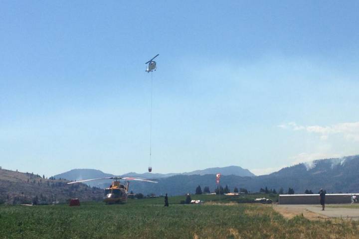
After a rogue drone grounded firefighting helicopters near Oliver for nearly five hours, the devices are again in the spotlight.

David Carlos owns Victoria Aerial Photos and Survey, a school that trains UAV pilots. He says commercial operators currently need licenses – but so far consumers don’t.

“But it’s coming. I really believe it’s going to come soon. Based on what we’re seeing happen. And, I think everybody … it should be like boating, recreational boating licenses. Even recreational people have to have a basic idea of what they’re doing.”

He says contrary to what some seem to think – the rules around flying them are very clear.

“And it says right there on the ‘don’t fly’ – it says ‘within restrcited airspace, including near or over military bases, prisons, and forest fires. Anywhere there’s a forest fire is restricted airspace, automatically.”

Carlos say Transport Canada does have clear rules about what’s allowed – but catching troublemakers can be tough.

He says incidents like today’s will likely lead to better enforcement.

http://www.cknw.com/2015/08/16/drone-school-owner-says-enforcement-coming-for-bad-operators/

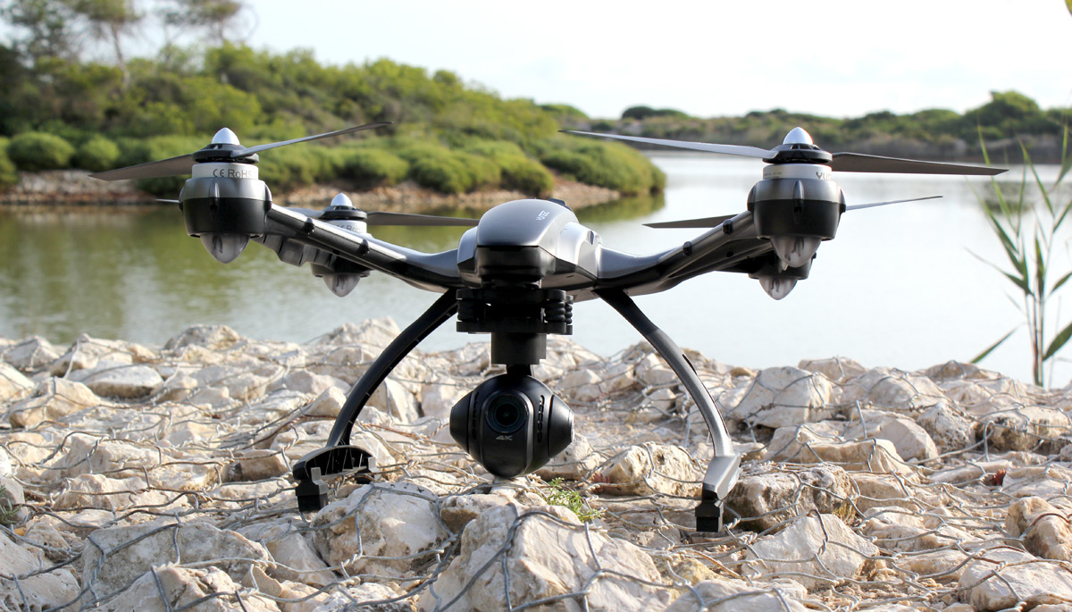
DJI’s Phantom 3 has it’s biggest rival in YUNEEC’s 4K Typhoon Q500

We’d understand if you’re not familiar with Yuneec; we’ve only written about its products twice. However, it’s fairly well-known in the quadcopter world, and best described as a direct rival to DJI. When I reviewed DJI’s 4K Phantom 3 Professional drone ($1,259), a reader asked if we could compare it to Yuneec’s rival Typhoon Q500 model (around $1,100, but with a lower-res 1080p camera). Days later, Yuneec announced an updated Typhoon with 4K shooting for $1,299, making the comparison much easier. It only seemed fair to grant our reader’s wish, and check out what the new Typhoon had to offer.

The similarities between DJI’s and Yuneec’s consumer quadcopters are many. Both have 4K cameras with stabilizing gimbals. Both are “ready to fly,” which mostly means there’s no assembly required; just charge and go. Both are easy for beginners to control, and both offer first-person view (aka FPV), or the ability to see what the camera is seeing in the air in real time, usually via the transmitter/controller. There are other products that offer a similar feature set, but DJI and Yuneec have done a good job packaging them in ways that appeal to new flyers and hobbyists alike.

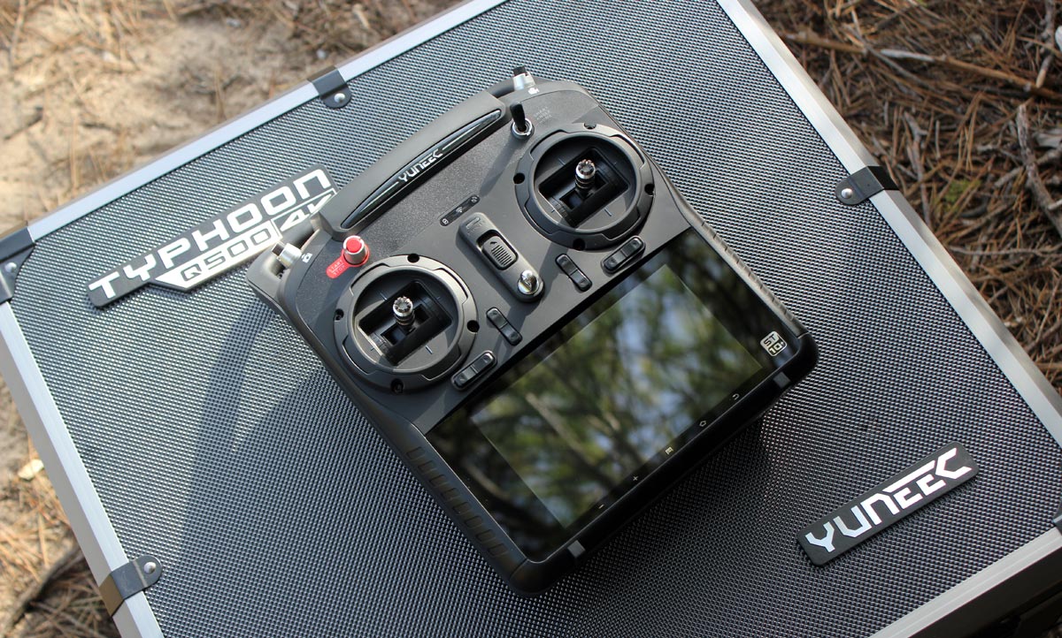
There are also some significant differences and on paper, at least, many of them are in Yuneec’s favor. Despite being slightly more expensive, the Typhoon offers better value. The $1,299 4K version is available with a carry case (you’ll need to buy one for your Phantom). It also comes with two batteries versus one on the Phantom. Then there’s the transmitter, which has a built-in touchscreen display. This is how you view what the Typhoon’s camera sees (you can also use it to access settings). In contrast, DJI users need a phone to do this, this approach works well, but is one more thing to bring along/charge. The last, and perhaps coolest extra with the Typhoon, is the Steadygrip, a hand-held mount for the 4K camera. Detach it from the drone, clip it to the accessory and you can film smooth video on the ground, too. DJI’s working on a similar product, but it’s not available yet, and won’t ever be in the box of the Phantom 3 (the camera is non-removable).

You’re also getting more flight features with the Typhoon. The ground station has GPS in it (actually, most quadcopters do, but not always the transmitter). This means the Typhoon has options like “follow me” and “watch me,” which Phantom 3 doesn’t have right now (but some features are coming eventually). So, the Yuneec is the one to get, right? Maybe. The real test is taking it up in the air and shooting some video. Which is, of course, what I did.

I’ll preface my impressions by stating that I learned to fly on a Phantom, and have flown one for many hours, so this is what I am used to. Yuneec made the Typhoon pretty easy to fly. I had a few minor wobbles the first time, but this might be because of my prior Phantom experience. One example is that, by default, the Typhoon won’t fly within 26 feet of you (or, really, the transmitter).

This caught me off guard when I first tried to land, as I’m used to bringing the Phantom in real close, and sometimes “catch landing” (getting it low enough to hold the landing gear, and make it think it’s on the ground). I had the Typhoon above water, and it wouldn’t come nearer. I had to walk backward far enough to be able to land it on solid ground, and not in an ideal spot (see the photo at the top of this article). The same problem can catch you out mid-flight, too. It’ll suddenly stop moving as it hits the exclusion zone around you. I get it; it’s a safety feature (and one you can turn off).

The Typhoon’s biggest problem in the air, I found, was that it’s not as responsive as the Phantom. DJI’s consumer product is quite a bit smaller, and responds quickly to any touch on the controls. You can throw it left to right quite sharply, and it’ll visibly pitch (but hold its position), and it manages to do so while keeping the camera steady — though if you really throw it, the landing gear/propellers can get in the shot. The Typhoon felt more sedate. Not sluggish, but less immediate. You can control its speed, but that doesn’t change the general responsiveness. Some might say this is a benefit, since I only once got propellers in the shot. But I do prefer the tighter feel of DJI’s setup.

What the Typhoon does have going for it is excellent battery life, so you get more time in the air. On average I got 20 minutes before it would start warning me to bring it home. The Phantom 3 starts complaining between 15 and 17 minutes, I’ve found. It might not seem like a big difference, but those extra few minutes feel like hours when you’re behind the sticks. One minor thing: I’ve never been a fan of how the Phantom 3 looks, but I like the Typhoon even less. As one colleague put it, it looks like it should fire Nerf bullets. It’s a little… on the boyish side. The Phantom 3 isn’t handsome, but smaller and more unthreatening.

Gallery | 10 Photos

Yuneec Typhoon Q500 4K sample shots

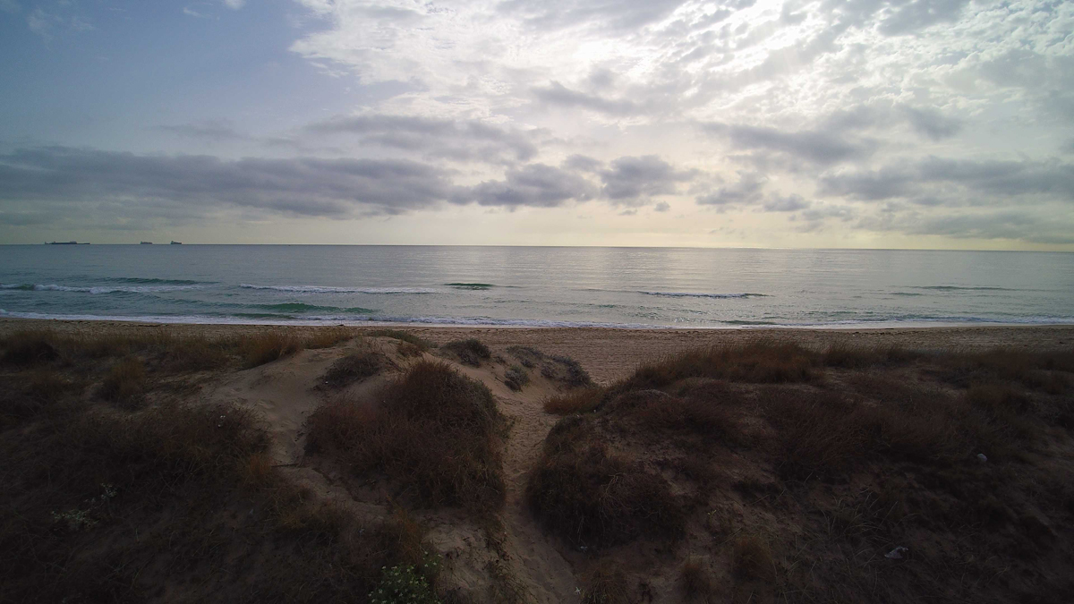
Most important for many people will be the quality of the camera. The quadcopter is going to be secondary for customers that are interested in the aerial video first. Here, I think DJI wins. The camera on the Typhoon is pretty decent, but it reacts to different light conditions with mixed success. In the sample video, you can see the difference with the direct sun in the opening clip (the second clip is just moments later, without the sun in shot), or spot the color/temperature of the ground change as I adjust the camera pitch between the 1:50 and 1:56 minute mark. On a positive note, there’s very little fish-eye curving going on, and the results are generally pleasing. But, between the two, the Phantom 3 Professional appears to have the edge.

With more time, I might get to love the Typhoon a bit more, who knows. Right now, though, I’m still leaning toward the Phantom 3. The Typhoon definitely offers more value, and the extra flight features will appeal to some people. But, if your priority is video and photos, or ease of flying, or both, the Phantom 3 steals it.

http://www.engadget.com/2015/08/16/yuneec-4k-typhoon-drone//


Regulation of UAV in Australia – a balancing act

uav

Earlier this month, Australian start-up Flirtey was involved in the first successful drone delivery to be legally conducted in the United States. This is the first step in what could be a revolution in the way medical and other supplies are provided in remote areas.

One of the key impediments to the use of drones in the United States has been its restrictive aviation laws (the recent successful trial in the United Stated required Federal Aviation Authority approval).

By comparison to the United States, Australia has less restrictive laws in relation to the flying of drones. The Civil Aviation Safety Authority (CASA) is in the process of reviewing and modernising the regulation of drones and expects to complete this by 2016. While the United States is looking to decrease the regulation of drones in order to stimulate technology development, there is speculation that Australia will introduce more stringent regulations in relation to drones.

Any new regulations will need to strike a balance between protecting the safety and privacy of individuals, without overly restricting the ability of Australian organisations to exploit this evolving technology and the commercial opportunities that go alongside it.

CURRENT REGULATIONS: Civil Aviation Safety Regulations 1998

CASA is the body responsible for regulating Unmanned Aerial Vehicles (UAV) in Australia. UAV are colloquially referred to as “drones”. Most UAVs are piloted by remote control and often mounted with cameras.

Under the Civil Aviation Safety Regulations 1998, UAV (weighing more than 100g and less than 100kg) cannot generally be flown:

  • higher than 400 feet;
  • within 10m horizontally and 30 feet vertically of a person (although there are exceptions to this prohibition for those involved in operating the UAV and others standing behind the UAV on take off);
  • over a large group of people at a height from which, if any of its components fail, it would not be able to clear the area;
  • over or near prohibited or restricted areas (such as an aerodromes or restricted military areas);
  • in conditions other than Visual Meteorological Conditions (i.e. bad weather);
  • in or into a cloud; or
  • at night.

It may be possible to use a UAV outside some of the above restrictions:

  • with the approval of CASA or another relevant authority (such as air traffic control); or
  • if the UAV is being operated within the sight of the UAV pilot.

There is also a general prohibition on flying a UAV in a manner which is hazardous to property, a person or another aircraft. The maximum penalty for contravening this provision is 50 penalty units (which currently amounts to $8,500).

Dropping off parcels or other items via a UAV is not prohibited, provided that nothing is dropped or discharged from a UAV in a way that creates a hazard to another aircraft, person or property.

In addition, companies that use UAVs must obtain an operator’s certificate from CASA and any individual that flies a UAV for commercial gain must have a controller’s certificate. There are currently 257 certified UAV operators in Australia, and with UAVs available for sale in Australian retail stores, this number is expected to increase exponentially over the coming years.

Can I fly over private land?

As UAVs are new technology, there is some uncertainty as to when the flying of a UAV over private property without permission will amount to a trespass to land.

A trespass to land is an interference with land owners’ rights. Land owners’ rights extend to the airspace over their land to a reasonable height.

There is no clear guidance on the height a UAV needs to be flown to avoid trespassing on private land. Based on past cases that have dealt with aerial photography from planes, scenic helicopter rides, and the height that bullets can be shot across land – as long as the UAVs are flown over land quickly and at a height that does not detract from the land owner’s use and enjoyment of their property, there is no trespass to land.

Will the Privacy Act apply to video footage taken by a drone?

The Privacy Act 1988 (Cth) only applies to Commonwealth agencies and organisations with an annual turnover of more than $3 million (with certain exceptions). Private UAV pilots and small companies (such as technology start-ups) would generally not be subject to the Privacy Act.

If an organisation is caught by the Privacy Act and it uses UAVs:

  • The video footage taken by the UAVs they use or control could potentially be considered “personal information” if someone can be identified, or reasonably identified, in the video footage.
  • Whether someone can be reasonably identified will depend on the circumstances. For example, footage taken by a UAV of a well known celebrity, or an individual that is well known to the organisation, would likely amount to the collection of personal information. The organisation would need to comply with the Australian Privacy Principles (APPs) in the Privacy Act regarding the collection and use of such personal information. Under APP 5, an organisation must take such steps as are reasonable in the circumstances to provide a privacy collection notice (this can be at the time of collection or, if that is not practicable, as soon as practicable after the collection). While there is a strong argument that it would not be reasonable or practicable to provide such collection notices in many instances where UAV video footage is taken of identified individuals, whether a collection notice needs to be issued will ultimately depend on the particular circumstances of each case.

CONCERNS WITH THE EXISTING LAW – A QUESTION OF PERSPECTIVE

An individual’s perspective

Currently in Australia, UAVs are primarily regulated from a safety perspective. There are no specific regulations which protect the privacy of individuals in connection with the use of UAVs other than those in the Privacy Act (which, as shown above, do not apply to individual private operators).

Unfortunately, except in exceptional circumstances, there is little that you can do to prevent a nosey neighbour from taking video footage of your backyard using a UAV. As a result, the government is under increasing pressure to enact legislation that prevents UAVs filming individuals on private property without their consent.

In the Australian Law Reform Commission’s report ‘Serious Invasions of Privacy in the Digital Era’ tabled in September 2014, it recommended the enactment of a new statutory cause of action for serious invasions of privacy. Such a new action could potentially apply to private UAV pilots if they recorded an individual in circumstances where the individual would have a reasonable expectation of privacy. This may assist individuals to take action against neighbours and unscrupulous operators who use UAVs in a manner that invades their privacy.

The commercial perspective

While introducing a new statutory cause of action would offer more protection to individuals, it would likely increase the administrative burden of operators in the emerging UAV industry. For example, real estate photography organisations may be required to obtain consent from numerous homeowners before they take sweeping footage of a property’s surrounds from a UAV which would be impractical.

As we have seen, the existing laws already create a number of issues for operators of UAVs:

  • there is no clear guidance on the height a UAV needs to be flown in order to avoid trespassing on private property; and
  • if an operator is subject to the Privacy Act, it is not always clear if and when such an organisation needs to provide a privacy collection statement to “identifiable” individuals, and otherwise comply with the privacy laws, regarding any video footage taken by a UAV.

To facilitate the use and investment in UAVs and new innovative delivery services, any new regulations should clarify the height at which UAVs can fly without risk of liability for trespass to private property and clarify that an organisation is not required to comply with the Privacy Act in relation to footage taken by UAVs. In addition, any new statutory cause of action for invasions of privacy should be carefully drafted to ensure it does not extend to incidental and non-intrusive drone video footage.

WHERE TO FROM HERE

While CASA is in the process of amending the regulation of UAVs and expects to complete this by 2016, it has indicated that the privacy issues associated with UAVs are beyond its remit. The new regulations will need to carefully balance the interests of ensuring its citizens are appropriately protected whist minimising “red tape” in order to encourage growth and investment in this emerging sector.
This article was provided courtesy of By Matthew Craven (Special Counsel) & Claire Harris (Graduate Lawyer), of Corrs Chambers Westgarth lawyers.

http://www.spatialsource.com.au/2015/08/17/regulation-of-uav-in-australia-a-balancing-act/

FLYING HIGH: Drone industry expands over Virginia

Posted: Sunday, August 16, 2015 8:00 am

WHITE STONE — The buzzing drone hovers 80 feet in the air and beams down a video so clear that each thread on a bolt 15 feet away is distinguishable.

With the dual blades on each of its eight arms spinning furiously while hoisting a high-tech video camera, this 25-pound flying contraption is replacing bucket trucks and helicopters for power-line inspection by Dominion Virginia Power.

And the giant utility isn’t the only organization banking on small unmanned aircraft to change the way they do business.

Drones are being used across the state and nation to do routine inspections of other ungainly structures such as cellphone towers and railroad bridges, often in a cheaper, faster and safer way than traditional methods. They fly over crops to help farmers see which areas need more water or fertilizer or to detect pest infestations early. And they could soon help emergency workers as they search for missing people or fight large fires.

The fledgling commercial drone industry is also finding a home in movies, real estate companies and other areas that see a benefit from overhead video, even as it’s limited by strict Federal Aviation Administration regulations keeping the aircraft no higher than 200 feet and within sight of the pilot.

The line-of-sight rule is the main obstacle for Dominion expanding its drone program to its emergency operations, where a drone could theoretically survey storm damage so the company would know exactly where and with what equipment to send its repairmen.

The utility could also use drones to inspect pipelines, rights-of-way and components of its power plants, Eisenrauch said.

About a thousand companies nationally have been granted the waiver that allows commercial use of drones, with a few dozen of those based in Virginia. The FAA is developing regulations, expected to be released next year, that will determine how companies can expand drone use while also ensuring safe operation in the national airspace.

Researchers at Virginia Tech are studying how to use drones for three-dimensional mapping that can identify terrain and buildings by type. They’re also trying to use special cameras to more quickly and accurately identify radioactive sources. Eventually, they hope to create software that will allow farmers to submit drone photos of their wheat and corn fields to identify fungus or other outbreaks.

The entire highway and railway systems in Virginia could eventually be inspected by high-speed drones, said Kevin Kochersberger, director of Virginia Tech’s Unmanned Systems Lab.

“The real advantage we see are that this could greatly speed up inspection, reduce cost and improve maintenance on the highway and transportation systems, as well as assessment of urban areas,” Kochersberger said. “(And) It’s not invasive. You’re not going to be blocking rail traffic or highway traffic in the process of inspecting these environments.”

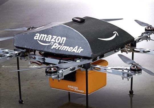
Amazon has announced plans to deliver packages to customers’ doorsteps using drones. Kochersberger, the Tech researcher, said he’s more convinced than ever that precision delivery could one day be more than a dream. His lab is creating a student competition to see who can design the best doorstep delivery drone.

But the days of drones replacing mail carriers are likely a decade or more away as the industry works to develop the technology to allow drones to sense and avoid obstacles and persuades the FAA it’s safe, said Jon Greene, associate director of the Mid-Atlantic Aviation Partnership.

And while package delivery may not be available soon, Greene said he expects the various uses of drones to continue expanding.

http://www.heraldcourier.com/news/local/drone-industry-expands-over-virginia/article_74e5090a-43b3-11e5-9bb8-87f01da09bac.html


Dealer’s drone shoots video to stand out


Dan Dorsey of the Jeff Wyler group says the drone can be flown by watching a monitor on the ground.

The Jeff Wyler Automotive Family near Cincinnati is going to new heights to wow vehicle buyers.

The 14-dealership group has purchased a drone — a remote-controlled, unmanned aircraft — to spice up promotions, social media campaigns and vehicle-delivery celebrations, said E-commerce Director Kevin Frye.

“In a highly competitive market, the need to differentiate yourself has never been more important,” Frye said.

This summer, Jeff Wyler Automotive paid $1,200 for the drone with a high-definition, GoPro camera mounted underneath the aircraft.

The camera is gyro-stabilized to minimize bouncing and disorientation while producing high-quality aerial photos and video, Frye said.

Frye, a former U.S. Navy aviator, said the drone is fun to fly. But Jeff Wyler Automotive has serious plans for it.

Perhaps the coolest use will be to provide customers taking delivery of vehicles with a memorable video. The camera will record salespeople handing over keys, hover shots of the driver through the passenger window and the car leaving the dealership.

That’s the kind of unique video that customers will want to post to their Facebook pages and other social networks, providing Jeff Wyler with indirect publicity, Frye said.

Frye envisions a multitude of other uses for the drone.

He said the Jeff Wyler Automotive video team has started experimenting with aerial shots of inventory lots to show shoppers the wide selection that each store offers.

The drone can safely fly up to 400 feet for the wide-angle shots needed to show inventory, he said.

Additionally, the video team has started shooting B-roll video and shots of dealership exteriors, logos and vehicles, Frye said.

Those will come in handy because the group sends vehicle videos and photos to shoppers whenever they inquire about a vehicle either electronically or by phone

Frye: Indirect publicity


Frye said the customary way of getting aerial dealership footage, hiring a helicopter, can easily cost $800 or more for one go-around. Just having that ability with the drone nearly pays for the cost of it, he said.

Other uses include shooting charitable and promotional events at the stores or highlighting Jeff Wyler’s contributions to the community. For example, the drone is being used to shoot the construction site of a new elementary school for the City of Milford, where Jeff Wyler headquarters are located. It also could record parades and fun runs.

Most of the videos and photos will be posted to store websites and social media channels, feeding those ever-hungry beasts for fresh content, Frye said.

The Jeff Wyler group ranks No. 39 on the Automotive News list of the top 150 dealership groups based in the U.S. with retail sales of 19,752 new vehicles in 2014.

Frye is no stranger to drones. In 1990, during the buildup to the Gulf War against Iraq, Frye flew on low-altitude missions that required military planes to be wary of early U.S. drones circling battlefields and waterways. That said, Frye and staff still have a learning curve on how best to fly and deploy the drone, he said.

The drone can be flown by watching a monitor on the ground, said Dan Dorsey, Jeff Wyler multimedia production manager. But the team has been using two-person teams with one watching the monitor to see what the camera is shooting and the other acting as a spotter to keep the drone from hitting trees and other obstacles, he said.

Frye said the group is in a trial stage, and there’s a chance the video produced eventually will lose the wow factor that makes it desirable today.

That’s a risk that the group is willing to take for a leg up on the competition.

“Sure, it could come and go,” Frye said. “But when you lead, you have to be willing to bleed.”


http://www.autonews.com/article/20150817/RETAIL/308179980/dealers-drone-shoots-video-to-stand-out


Drone shuts down air operations at Oliver fire scene

firehelis

BY BETHANY LINDSAY, VANCOUVER SUN

OLIVER, B.C. — The intrusion of a small drone into the airspace above an uncontained wildfire near Oliver grounded the entire fleet of aircraft working on the blaze for most of Sunday afternoon.

Eight helicopters and an air tanker team were all put out of action when the drone flew close to the Testalinden Creek fire at about 12:45 p.m. Sunday.

It took about five hours for crews got confirmation that it was safe to fly again.

“You can’t even imagine” how frustrating this is, fire information officer Noelle Kekula said during the delay.

“The fire is active and our No. 1 objective is to protect (homes). This is incredibly serious.”

Without “helicopters bucketing places,” members of the Oliver district fire department were forced to “climb the hillsides with hoses in their hands,” said deputy fire chief Bob Graham.

It meant “we had to go out and protect more of the area. The terrain is very steep and rocky and it’s difficult to access some of the spots.”

The RCMP worked to find the drone late Sunday afternoon, but had not found it or its operator.

The airspace over any active wildfire is automatically considered restricted, and Transport Canada regulations make it illegal to fly within five nautical miles to either side of the flames or less than 3,000 feet above it.

Violations can result in a fine of up to $1,000 for individuals or $5,000 for a corporation.

This marks the second time this year that an unmanned aircraft has interfered with crews fighting wildfires; a drone hovering around the Westside Road blaze near Kelowna earlier this summer shut down air operations there as well. The only other previous case of a drone flying too close to a wildfire in B.C. happened last summer in the Okanagan.

The most recent drone was a significant nuisance to firefighters in Oliver, who had yet to make any progress on containing the 15 square-kilometre fire. .

Incidents involving recreational drones interfering with planes and helicopters have been on the rise in recent years.

Earlier this month, a drone narrowly missed a seaplane as it landed on the Fraser River at Vancouver International Airport. The same week, a Cessna 172 flying over Stanley Park reported a drone buzzing around underneath it.

By August 6, 19 incidents involving drones had been reported to Transport Canada in 2015.

A recreational pilot operating a drone weighing under 35 kilograms doesn’t require either a licence or a special permit to fly but must follow a list of Transport Canada safety guidelines. Commercial operators, on the other hand, need a special flight operations certificate that includes restrictions on things like altitude and minimum distances from airports.

Some observers are calling for Transport Canada to crack down on recreational drone users.

“Public awareness and enforcement is lacking,” said Ernie Zeisman, president of a drone-training outfit in the B.C. Interior. “They need to begin clamping down.”

Transport Canada is holding consultations about possible regulations for recreational drone users. Some of the proposed amendments include minimum age requirements, knowledge tests, aircraft marking and registration, and pilot permits for some operators.

With files from The Canadian Press and Gordon Hoekstra and Joanne Lee-Young

Read more: http://www.vancouversun.com/news/Drone+shuts+down+operations+Oliver+fire+scene/11294451/story.html#ixzz3j3CCTVaK


Amazon chief Jeff Bezos hails UK drone rules

AmazonPrimeAir

Murad Ahmed, European Technology Correspondent

Amazon founder and chief executive Jeff Bezos has hailed the UK’s regulatory regime for drones, as the online retailer hints of the possibility of launching its flying delivery vehicles in Britain before initiating lift-off worldwide.

Mr Bezos said UK’s rules on unmanned aerial vehicles represented “a very encouraging example of good regulation”.

His endorsement comes amid growing hope that Britain can become an international hub for the non-military drone sector, a belief that stems from the fact that the UK’s regime on drones is more relaxed than elsewhere, particularly the US.

Britain’s Civil Aviation Authority has granted permission to more than 850 commercial groups to conduct aerial work in the country using the machines.

This regulatory regime has allowed US tech groups to set up test bases in the UK. Amazon began trials for its fleet of delivery drones in Cambridgeshire last year, having quickly gained the blessing of the UK authorities. But the Seattle-based company has had to wait months to gain similar permission to test its vehicles at home, with the US Federal Aviation Administration only granting approval last March.

 http://www.ft.com/intl/cms/s/0/d5869f38-4405-11e5-b3b2-1672f710807b.html#axzz3j3ANTCW4


Iowa State Extension field day to include information on drones

ISU researchers look over a drone.

An Iowa State University field day at the end of this month will feature a discussion on using Unmanned Aerial Vehicles on the farm. Ryan Bergman in the ISU’s Department of Ag and Biosystems Engineering is the organizer of the field day.

He says the UAV’s can be another tool used by growers. “There’s still a lot of unknowns in the area of UAV’s and aerial imagery specifically in the agriculture sector,” Bergman says. “And so a lot of what we are going to be showing at the field day, and a lot of the research that my team is doing here at Iowa State is focused around how do we utilize this imagery to help us make better management decisions for our operations and allow us to cost-effectively utilities this new tool.”

Bergman says the images from the drones can turn up many issues in the fields. “We can tell a lot of differences across the field, compaction issues show up relatively well in a lot of aerial images, drainage issues show up extremely well. Those are some of the early things that we are seeing, but we think there a lot of other uses that we can employ aerial imagery in down the road,” according toe Bergman.

While the drones are a new tool to get information on your crops, Bergman says its just one piece of the puzzle. “Whatever you are see in the imagery — at this point we aren’t recommending that you can make a management decision of that really — unless you can verify it on the ground what’s happening. It’s completely visual, so there can be a lot of times be other factors that are affecting that image and it may not be due to the crop,” Bergman says. He says growers will still have to do some leg work once they find potential issues in the images from a drone.

“That’s one thing that we’ve really been stressing — if you see something in the image that should tell you where in the field you should look — and then you go out there and look. And based on what you are seeing in the field based on the image, then you can make a decision off of that,” Bergman explains. An attorney with the Center for Agricultural Law and Taxation at Iowa State will also be on hand for a discussion on the legal issues surrounding UAV’s.

“That’s still kind of a gray area right now, and so that’s why we have her coming to kind of talk through some of those issues with the growers,” Bergman says. The field day is August 27th at the ISU research farm located near Boone on Highway 30. The field day starts at 8:30 and is free to the public.

http://www.radioiowa.com/2015/08/15/iowa-state-extension-field-day-to-include-information-on-drones/

Drone use shot down by Aspen Skiing Company over ski areas

aspenskijump

by Chad Abraham, Aspen Daily News

The Aspen Skiing Co. has informed the photographers with whom it contracts that they are not allowed to use aerial drones on the four ski mountains, clarifying what had been a gray area as popularity grows for the devices.

The policy, announced Thursday, also holds true for the public, and the regulation mirrors U.S. Forest Service rules on drones. The federal agency prohibits their use on public land unless a drone flier has obtained an exemption from the Federal Aviation Administration.

SkiCo decided to formalize its drone policy in writing and on its website because it is simply too dangerous, said spokesman Jeff Hanle.

“It’s way too risky to have those things flying around,” he said, noting the danger to people riding chairlifts and the proximity of Buttermilk to the Aspen-Pitkin County Airport. “Buttermilk is right there in the flight path.”

A man was cited for a misdemeanor in January for flying a drone near Buttermilk during the X Games. ESPN, which produces the extreme sports event, obtained permission from the FAA for the drones it used to film, Hanle said.

Others who have the FAA exemption for local drone use include producers of films and commercials. But as the technology has progressed and prices have dropped, drones mounted with cameras have exploded in popularity for people using them recreationally.

Matt Hobbs, owner of locally based Vital Films, has conducted multiple shoots on the ski areas. He’s also filmed public service announcements using a drone for, ironically, the Forest Service, he said.

Until the Forest Service established its zero-tolerance policy on the devices, film- and commercial-makers were in “uncharted territory,” Hobbs said. “The biggest thing, from my understanding, is that airspace [away from airports] can’t be controlled, just where you take off and land from.

“Everything’s just so gray now, which is why we chose to back off for now.”

He said his company now only flies drones on private property.

Hobbs provided a Forest Service memo issued in March that cites the FAA’s position on drones: “Operators who wish to fly an unmanned aircraft for civil use must obtain an FAA airworthiness certificate. Certificates are issued with accompanying operational limitations that are appropriate to the applicant’s operation.”

The Colorado Passenger Tramway Safety Board, which has oversight over ski lifts, mandates that helicopters used in commercial filming stay a certain distance away from ski lifts, Hanle said, adding he assumed the same regulation would cover drones. Efforts to reach a representative of the tramway board were unsuccessful.

SkiCo has used drones in its own commercial efforts, and “we’ll now make sure we’re permitted and check with the FAA,” Hanle said.


http://www.aspendailynews.com/section/home/167850