AL: Birmingham City Council buys a drone … for what?

phantomface

By John Archibald

The Birmingham City Council is buying a drone. That’s right, a drone.

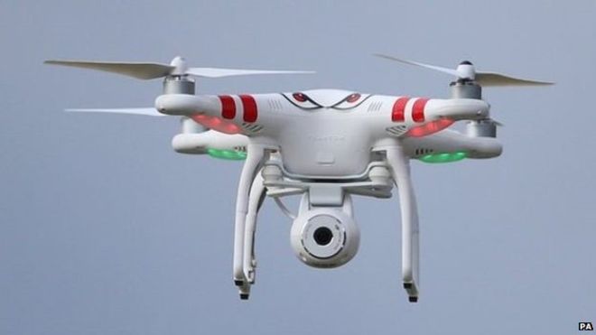
The purchase is underway for a taxpayer-bought DJI Phantom 3 Advanced Quadcopter with camera and gimbal, complete with three-year warranty. It’ll cost you $1,198.03.

Why does the city council want a drone?

To shoot beautiful soaring video, of course. Even though use of drones for that practice is touchy and in many cases illegal. But hey, let’s give them the benefit of the doubt and assume they will abide by the rules.

Ha! I’m joking. Because this is the Birmingham City Council.

But here, really, are the top reasons the Birmingham City Council would want to purchase a drone in the first place:

  • To distract people while they give themselves another pay raise. “Hey, what’s that up there?” Cha-ching!
  • Because – as they prove every Tuesday – they can drone on for hours. And hours and hours and hours.
  • Because even Lashunda Scales agrees that Vulcan-to-Air missiles are impractical. Fun, perhaps. But impractical.
  • Because … what could go wrong?
  • To scout new places for their next extravagant retreat. Or a new spot for the dome we’re already paying for.
  • Because those soon-to-be-illegal serial meetings are going to be too hard to pull off. Unless you can pass notes with a drone.
  • Because there is as yet no law against Droning Under the Influence.
  • So they can finally prove to themselves that they actually control something. (Look out below!)
  • Because they have long believed no ship really needs a pilot. Just ask the mayor.
  • To constantly bomb household targets with pamphlets describing – on paper paid for by taxpayers – what a marvelous job they are doing. See your city council in action!
  • Because it costs only a 10th of what Council President Johnathan Austin paid operative Frank Matthews from discretionary funds last year, and it cusses a whole lot less.
  • Because Birmingham residents need something to shoot at besides each other.
  • Because those council members are such frequent flyers they are only comfortable with a bird’s eye view.

And finally, the real reason the Birmingham City Council needs to buy its own drone is…

Because it’s only money.

Because it’s only your money.


http://www.al.com/opinion/index.ssf/2015/09/birmingham_city_council_buys_a.html

New super-precise drones could win over wireless industry

prenav drone

Bob Brown


PreNav drones

PreNav demos precision drone flights via an LED lightshow

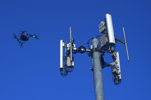
Big IT companies have largely been mum on plans to use drones, but emerging technology from Bay-area startup PreNav appears to have at least intrigued wireless service providers and cell phone tower operators.

Founded in 2013, PreNav has secured $1.2 million in seed funding and is working on raising Series A financing. It is currently beta testing its precision drone technology, which carriers/tower operators could use to inspect towers in a safer and more efficient manner. The drones could zoom in on everything from nuts-to-bolts (literally) and cabling, plus deliver 3D images that customers can use to determine a tower’s structural status. And with more than 100,000 towers in the U.S. alone, that could present PreNav with a big opportunity.

Other potential customers include wind turbine operators, such as early user Senvion, as well as outfits overseeing everything from bridges to dams to oil rigs.

PreNav next year plans to roll out its 3-piece system, which consists of roughly 9-pound industrial grade drones, a ground-based guidance robot that includes a powerful embedded processor, a camera, laser rangefinder and wireless tablet for the user interface, plus cloud-based software to process, analyze and share data. The robot scans the structure and then guides the drone around it “with centimeter-level accuracy” to take photos that are then turned into a 3D reconstruction. This is a much more precise and reliable system than those based on GPS technology, which has difficulty understand the relationship between a drone and a structure being examined, according to PreNav.

PreNav is pushing this video in which LEDs on drones are used to showcase precise flying patterns.

Top security tools in the fight against cybercrime

There’s no silver bullet, so load up with as many of these as you can.
PreNav claims the system, initially targeted at the U.S. market, can be operated via the touchscreen interface even by those who don’t have manual piloting skills. What’s more, PreNav says it is working to enable tower inspection, including drone setup, in less than an hour.

The startup is the brainchild of CEO Nathan Schuett and CTO Asa Hammond, who previously worked on camera systems and computer vision applications as contractors for Google and some Bay-area startups. Among Hammond’s claims to fame was developing a robotic motion control system for a design firm (and eventual Google acquisition) called Bot & Dolly used to shoot the movie Gravity.

The company’s drone system would seem to sync up well with the direction of the FAA, which has been overseeing drone/unmanned aerial vehicle (UAV) rules in the United States.

“PRENAV supports the notice of proposed rulemaking (NPRM) issued by the FAA back in February 2015. By removing the requirement to have a certified pilot in command of the aircraft, drones can be used by a much broader range of people, namely the existing industry of climbers, technicians, and anyone who is inspecting or maintaining industrial assets. Further, the rules focus on drones that fly within line of sight of the operator, which aligns well with the applications PRENAV is targeting with our system.”

With drone rules becoming clearer in the U.S., funds increasingly have been flowing into drone-focused startups. One of PreNav’s investors, Drone.VC, for example, specifically targets drone companies. Crunchbase showed that some $210 million had been pumped into drone startups this year through mid-June.


http://www.networkworld.com/article/2981697/service-providers/new-super-precise-drones-could-win-over-wireless-industry.html

Ohio college dedicates new drone center

DAYTON — A new one-stop center for the design, construction and testing of drones is ready for use at a college in southwestern Ohio.

Sinclair Community College recently dedicated its $5 million National Unmanned Aerial Systems Training and Certification Center. The center will provide students with access to 3-D advanced manufacturing, drone simulators, a wind tunnel and improved labs

Regional leaders said the renovated 28,000-square-foot building will have about 120 drones. Nearly 500 students will take classes in the facility during the first academic year.

The state provided about $4 million for the renovations. The college picked up the remaining $1 million.

Sinclair officials said it will give graduates an edge in the job market.

“Someday, UAS will have as much impact on people’s lives as PCs or cellphones,” said Robert Connelly, chairman of the Sinclair’s board of trustees.

The Association for Unmanned Vehicle Systems International predicts the industry will create 2,700 jobs and have a $2.1 billion impact in Ohio by 2025.

“Wilbur Wright, one of the famous brothers from Dayton who invented manned aviation, said to be successful, begin life in Ohio,” said Brian Wynne, president of the drone association. “Today, Ohio and Dayton are again at the center of new generation of aviation: unmanned aircraft systems.”

http://www.dispatch.com/content/stories/local/2015/09/08/ohio-college-dedicates-new-drone-center.html

Four Farmers Form Flying AG

Unmanned Aerial Vehicles (UAV) offer a whole new perspective on how you scout and manage your fields. Not only can they help identify potential problems earlier, they may also increase yield by identifying areas where inputs should be applied.

“Before using UAVs, I had to walk fields with 10-foot corn in the heat of the day to look for problem areas,” says Indiana farmer Corey Jacobs. “Now, I don’t have to be out there; I can scout my fields from above and get a bird’s-eye view of crops. It’s a whole new perspective.”

Jacobs has always been an advocate for improving technology practices on his family’s farm in rural Indiana. He saw immediate benefits of UAVs on his farm, which raises hogs and grows 1,500 acres of corn, and wanted to be able to offer the technology to others.

California farmer Martin Hein adds that, “This technology provides real-time information that can impact current high-value crops and the long-term future of established fields, groves and vineyards. Aerial imaging technology provides immediate data so farmers and growers can react quickly to changing conditions and opportunities.”

Hein is a fourth-generation California grower, managing 5,500 acres of almonds, avocados, citrus and grapes. As a commercial grower and an Accredited Farm Manager, he has experienced first hand how real-time information can impact crops. He relies on aerial imagery to provide immediate data so  he can react quickly to changing conditions in high-value crops.

The two men have joined forces with fellow growers Randy Aberle and Jason Schmidt to form Flying AG.

“We are offering products currently available in the market, but we are adding more value with our access to experts and by providing superior support, training, and service to our farm customers,” says Aberle, who raises corn, soybeans and wheat on his 1,500-acre farm outside of Gibson City, Illinois.

Aberle’s farming business is very technology focused. In addition to variable rate planting and input applications, he has also integrated aerial imaging into his operation. He has been flying his fields for the last five years,, which has allowed him to pinpoint problem areas like hail damage and bug infestations in early stages.

Schmidt has been a farmer in central Illinois and is a Channel Seed salesmen. Soon after learning about UAV’s application in ag, he recognized the value of aerial imaging technology for farmers who wanted to assess their field conditions and use real-time information to find effective solutions.

“At the end of the day, we want to provide good-value unmanned aerial systems and expert technical support to farmers who desire an advantage in both prosperous and challenging times,” notes Schmidt.

Learn more by visiting flyingag.com.

http://www.agriculture.com/technology/robotics/uas/four-farmers-fm-flying-ag_587-ar50216

Criminal Charges Filed Against Teacher Who Crashed 3DR Solo Drone into U.S. Open

Daniel-Verley

Enrico Schaefer

How might ‘The U.S. Open Drone Guy” defend himself in Court?

You can be prosecuted for violating FAA regulations, or state criminal laws for negligent or reckless drone operation.  Just ask Daniel Verley. He crashed his drone into the stands at the U.S. Open tennis tournament and has already been charged with criminal recklessness.

What are the possible defenses Daniel Verley can assert against the criminal charges of “reckless endangerment, reckless operation of a drone and operating a drone outside the prescribed area” filed against him by the New York prosecuting attorney?  We still don’t know much.  But we can guess how this drone accident might be defended in court.

The school teacher from New York City turned himself and and was was arrested early Friday morning, hours after he allegedly crashed a small #DR Solo quadcopter drone into the stands at the US Open tennis tournament in Queens, New York.  It is unclear whether he gave a statement to the police and incriminated himself, or exercised his right to remain silent (which would have been a good idea in this situation for sure).

We have not seen the formal charges, but one likely charge is violation of New York Penal – Article 120 – § 120.20 Reckless Endangerment in the Second Degree.  It’s a misdemeanor.

§ 120.20 Reckless endangerment in the second degree.
A person is guilty of reckless endangerment in the second degree when he recklessly engages in conduct which creates a substantial risk of serious physical injury to another person. Reckless endangerment in the second degree is a class A misdemeanor.

Endangerment involves conduct that is defined as reckless or wanton, and likely to produce death or bodily harm to other people. THE threshold of proof for the New York prosecuting attorney will be establishing that  Mr. Verley recklessly engaged in conduct which created a substantial risk of serious physical injury. So what was Mr. Verley’s conduct?

Don’t Convict Daniel Verley Just Yet. He is innocent until proven guilty.

It could be that Daniel Verley  was flying his drone and lost site of it, accidentally flying it into the US Open stadium by accident.  If that is the case, and he was otherwise operating safely, the prosecuting attorney may not be able to establish beyond any reasonable doubt that his conduct was “reckless” or that Daniel Verley exhibited a “culpable disregard of foreseeable consequences to others.”  The crash itself won’t be enough proof to get a conviction.

This case will be interesting as it may set the stage for many state criminal cases charging reckless drone operation.  Drone crashes are becoming more common.   Flying drones over people ‘for fun’ and ‘great video’ is starting to happen with more frequency.  Flying your drone over people who are not part of the flight is considered poor form, at the least, and considered unlawful to many including the FAA. Each state get’s to decide for itself what it considers reckless.  And attorneys will argue whether state criminal and civil laws are preempted by federal laws and FAA regulations which allow certain flights.   We expect lots of drone operators to claim that the drone simply flew off. “Blame it on the drone” will become a very common defense against criminal charges brought against drone operators, as well as defenses to negligence claims causing injury to property damage. Drones are notorious for “complaints of fly aways.”

While the prosecutor does not have to establish ‘intent’ – i.e. thatDaniel Verley  intended to cause harm, the ultimate question is whether, under all the circumstances, the accused’s conduct was made it actually or imminently dangerous to the rights or safety of others.

So don’t convict Mr. Daniel Verley as guilty just yet.  We have not heard his side of the story.  If he is smart, he turned himself in and immediately pled the 5th Amendment, and remained silent.  The prosecuting attorney needs more evidence than the drone crashing at the U.S. Open stadium to prove reckless endangerment.  He will have to show that the operation was reckless. Here are factors which might be used against Daniel Verley in court, assuming the prosecuting attorney can get the evidence admitted though witnesses:

  • If Daniel Verley admits he was trying to fly into the stadium, or above the stadium, to take pictures in or around the U.S. Open.  This might be deemed reckless as it violates any number of flight standards and regulations. Recreational and hobbyists may not be able to pled ‘ignorance’ when it comes to safe flying standards.  If you buy and fly a drone without educating yourself, that could be deemed a indication of recklessness.
  • If Daniel Verley had little experience flying a drone before putting it in the air.  While fly -aways happen all the time, the are mostly caused by user error.  Flying in the wrong flight mode, mistaking how your joysticks navigate the aircraft and entering the wrong ‘home point’ are rookie mistakes.
  • Flying beyond ‘line of sight’ is a big no-no.  The recreational drone community understands that you never fly beyond what you can see.  Jsut because you can fly, does not mean you should.  And just because the drone can travel well beyond your ability to see it, does not mean you should.
  • One big issue will be whether a prosecuting attorney can introduce community Remote Aircraft standards such as “know before you fly” standards or FAA regulations.  We all have a good idea of what it means to drive negligently or recklessly.  It is unclear what constitutes unsafe flight.

One of the ironies here is that If Daniel Verley was a teacher at Academy of Innovative Technology in Brooklyn.  This suggests he may have had previous drone experience as a pilot.  UAV are THE most innovative technology on the market right now.  The fact that he was flying a pretty expensive 3DR Solo (Over $2,000 with camera and extras), also suggests that he may not have been a novice.

The FAA can also Levy fines as high as $10,000 for reckless operation of a drone in the NAS.

Let’s not forge that the FAA has jurisdiction over the National Airspace (NAS) and can levy fines against commercial drone operations as well as hobbyists. It would not be surprising to see the FAA issue fines for Verley as well before this is over.

https://www.dronelaw.pro/criminal-charges-filed-against-teacher-who-crashed-3dr-solo-drone-into-us-open/

Malaysia:Educating enthusiasts on safe use of drones

6 September 2015 @ 6:09 PM
WHEN a drone enthusiast posted pictures his drone took in Kuala Lumpur International Airport on social media recently, it caused an immediate backlash from the public.
Some believed the lightweight drone could have been sucked into a plane’s engine and cause the plane to crash, risking many lives.
Apart from violating the Department of Civil Aviation’s (DCA) regulations that prohibits drones being used for recreational purposes in controlled airspaces, such as airports, he had no qualms about posting his images online.
Drones are unmanned aircraft, formally known as unmanned aerial vehicles (UAVs). They are most often associated with the military, but are also used for search-and-rescue, surveillance, traffic control and weather monitoring. Personal drones are currently a hobbyist’s item, used often for aerial photography.
Recently, however, there have been issues concerning the lack of safety rules and regulations as drones are seen flying in prohibited areas such as airports, near government buildings and around the city centre.
In 2013, a local politician concluded that his bungalow was being filmed using a drone by political rivals hoping to find evidence of financial irregularities.
Malaysia is not the only country with concerns about drone safety. After a few near-misses, Paris has been declared a no-fly zone for UAVs. If you’re caught flying a drone there, you could be slapped with a RM317,833 fine and a maximum of five years in jail.
In Thailand, the use of UAVs is prohibited, unless it’s for research and educational purposes. Illegal use of drones is punishable with a year in prison and RM4,435 fine. However, the drone community is adamant to prove that there are far more benefits than what is being reported.
Drone Malaysia co-founder Hamdi Hamdan, 42, said any vehicle in the hands of someone with bad intentions posed a risk, and not just drones. “We can’t control people’s intentions. It is the same as buying a car to rob a bank. Are you going to blame the car? It all comes down to good and bad intentions. “I’m not going to deny that we do have customers who buy drones to spy on people they have a crush on, or to monitor the whereabouts of their rivals.
But those cases are few and far between. “Many people are interested in drones because they want to take ‘dronefies’. “Instead of using a selfie stick to take selfies and wefies, people are using drones to capture images of special occasions.” “But drone users like us are afraid that if something goes wrong, the government might ban the use of drones for personal use altogether.”
Hamdi said while authorities were in the midst of setting guidelines for commercial drone flying, drone hobbyists are left in the dark, causing safety to be a major concern.
“Malaysia is still immature in matters concerning drones. In countries like Singapore, banks and insurance companies offer third-party cover for drone associated mishaps. “Everyone is on-board because, like it or not, drones are around and there are many who are passionate about them. The drone industry in Malaysia is growing fast so we can’t afford to be lax about safety matters.” He said even enforcement agencies like the Immigration Department were using drones, and the police recently announced that they would be starting a drone unit.
A recent report had quoted Inspector-General of Police Tan Sri Khalid Abu Bakar as saying the drone unit, which was set up under their Air Unit, was expected to start operation by the end of this year. “Currently, our officers are undergoing training to operate the machine, while standard operating procedures for the technology utilisation are being worked on. “We are going to start small, with three or four drones. They will be used to assist patrol duties in the Klang Valley,” Khalid had said. He was also reported to have said that police were planning to acquire facial recognition software, which can be paired with the police database, to detect the whereabouts of wanted criminals and terrorists using traffic cameras and patrol drones.
Hamdi said many large corporations already know the usefulness of drones and have been using it for a long time. “In the past, these companies used to rent helicopters, but drones are a much cheaper option. “Why bother with the hassle and cost of going through a delivery service? “We’ve been approached by medical practitioners to help them develop drones to deliver medication. For them, to hire a dispatch is expensive, and in an emergency situation, drones are efficient.”
Drone Malaysia, he said, aimed to educate drone hobbyists on safety. “We have about 11,000 members. There is no age barrier; we have young women in their 20s and men in their 60s. We organise get-togethers to share knowledge and exchange experiences. “We even have European tourists who seek our advice on safe locations to fly drones in Malaysia.”
Drone Malaysia will be organising a first of its kind drone race on Sep 26 and 27 from 10am to 6pm at Sukaneka Field, Universiti Malaya.
More information can be found on www.mydronegp.com.

Read More : http://www.nst.com.my/news/2015/09/educating-enthusiasts-safe-use-drones

Supporting Blasting Operations with UAS

image

Using unmanned aircraft systems (UAS) imagery and mapping software Pix4Dmapper, the Explosives Risk Managers company supported quarries in Virginia and Ohio: accurately measuring stockpile volumes and excavated materials, measuring borehole locations, and monitoring blast sites, all at a low cost, high accuracy and in completely safe worker conditions…

Project Description

image

As technology for acquiring aerial images improves, UAS have emerged as providers of ideal, flexible visual perspectives which might not otherwise be attainable due to personnel safety and high cost. Additionally, the U.S. Federal Aviation Administration (FAA) implemented an exemption process and regulation for commercial operators in late 2014, opening the sky for many UAS applications.

image

The aim of these projects, surveys of a stockyard and a blasting operation in the states of Virginia and Ohio by the Explosives Risk Managers LLC (ERM), was to support blasting without putting people in danger. UAS flying at low altitude can take images or videos with extremely high resolution and at any angle. UAS can be applied to assist the blast-in-charge with post-blast inspections. During the blast cycle, using a UAS minimized the personnel risk and ensured the blast area was secure.

Data Acquisition

image

A DJI Inspire1 and Phantom 2 Vision + was used to acquire images and videos over stockyards, capturing images at only 45 meters altitude and at 2 cm GSD. 6 ground control points were used to assure global accuracy of the stockpile survey.

image

Achieved Results

With the assistance of the photogrammetric software Pix4Dmapper, several 2D and 3D outputs were obtained. Those results enabled the following measurements and analysis as well as provided deep background for future hazard prevention.

image

The stockpile volumes were accurately measured with a hundred-million-point point cloud generated. Models of before and after cut volumes could be compared to determine the volume excavated. Fill volumes are also monitored and kept track of for more efficient equipment use and to limit over-handling the excavated materials.

The 3D model of a blast bench can be combined with data from a borehole tracking system to identify areas of weakness and over-confinement. The results and the spatial information of the scene were preserved for later analysis, engineering applications of potential post-accident comparisons, and historical records.

image

The topographic maps and the digital surface model (DSM) were used to make engineering decisions on design and quality control of the entire project, and the orthomosaic was used for determining the accuracy of borehole collar locations and measuring actual burdens and spacing for drilling applications. It was also imported into WipFrag (fragmentation analysis software) to determine size distribution of pile surfaces.

image

Advantage of This New Technology

UAS and Pix4Dmapper can provide more precise survey data for less cost. Processing all the acquired images took only a few hours, generating a point cloud, 3D model, and orthomosaic of the entire region. The high resolution 3D model made before blasting provided valuable blasting data, the images and videos captured on the day of blast helped clearance of the blast area, and after the muck was removed, the full cycle is completed by making another post-blast 3D model. These procedures cost a lot less time and money than traditional aerial photogrammetry, yet provide much more detailed spatial information, and they are also less influenced by most weather conditions. Conclusively, the new technology of UAS-image processing can perform entire tasks efficiently and in completely human-safe conditions.

image

Author:

Lon Santis (Principal of ERM LLC)

Dale Ramsey (General Manager of Senex Explosives)

Lisa Chen (Technical Communication Manager of Pix4D SA)

http://blog.pix4d.com/post/127642506041/supporting-blasting-operations-with-uas