FAA approves startup to operate a giant fleet of drones

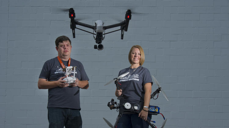
The Federal Aviation Administration recently approved a small drone startup called Measure to fly 324 drones for business purposes.

It may not be long before we see fleets of drones buzzing across the sky.

The Federal Aviation Administration has given a startup called Measure permission to fly 324 drones, the company announced on Tuesday.

But Measure won’t be using its drones to deliver toothbrushes, medical supplies, or diapers like other companies have been itching to do. Instead, Measure will use its drones to gather data.

As Fortune reported in July, the Washington, D.C.-based startup operates a drone consultancy and services business that works with clients to figure out how drones could help them. It focuses on the agriculture, oil and gas, insurance, and other industries in which aerial photography and other data is a valuable commodity.

Boeing BA 2.52% , IBM IBM 1.66% , UPS UPS 1.59% , and the American Red Cross are all users of Measure’s drones, according to CNN.

Companies looking to fly drones for business purposes must currently seek approval from the FAA and abide by a series of rules including flying no higher than 400 feet above the ground and always within the line of sight of human operators. These rules have made it difficult for companies like Amazon AMZN 2.82% to get drone-delivery businesses off the ground.

Measure, however, seems to have had an easier time getting the FAA approval because it wants to use its drones to collect data and not deliver goods. In a letter to the FAA, Measure said that it intends to comply with the flight altitude ceiling and make sure that its human operators keep a close watch.

In July, a drone operated by a small startup called Flirtey made the first legal drone delivery sanctioned by the FAA.

FAA releases UAS safety app

By Ann Bailey | September 01, 2015
  • FAA has released an app that the agency hopes hobby UAV operators will open before they fly.
    PHOTO: UAS MAGAZINE

The Federal Aviation Administration (FAA) hopes that unmanned aerial vehicle users will check its app before they fly.

The FAA has released for testing the beta version of B4UFLY. The app is a way to help the operators know whether or not there is a conflict in the air space in which they plan to fly, the FAA said. The beta test will run at least 60 days.

One thousand UAV users received the B4UFLY APP which primarily is for model aircraft enthusiasts. The app is unavailable in the beta version in the Apple store, but the FAA is maintaining a waiting list in case the 1,000 users do not download B4UFLY. People who want to be added to the waiting list should email b4ufly@faa.gov, the FAA said.

The FAA hopes that by using B4UFLY, conflicts between manned and unmanned aircrafts will be reduced. The agency is concerned about the increase of reports of unsafe operations of unmanned aircraft near airports, over people and near manned aircraft.

Although, B4UFLY is targeted at hobby or recreational UAV pilots, the FAA believes that civil and commercial operators will find aspects of B4UFLY useful.

The app uses a location services feature of users’ smart phones to determine whether restrictions or requirements are in effect where they want to fly and gives users a clear status icon. The status indicator functions considers factors such as airspace, proximity to air ports and temporary flight restrictions.

Some other notable features of the App are:

–          Informative, interactive maps with filtering options.

–          Information on the parameters that drive the status indicator.

–          Links to other FAA UAS resources and regulatory information.

The app will allow the model airplane pilots to have access to the information, provided they have a cell phone signal. B4UFLY obtains the information from public data sources and packages it so it is user friendly, the FAA said.

The agency plans to release a full version of B4UFLY to the general public before the end of this year. The beta test is only for IOS devices, but the FAA is working to ensure the full version also will be compatible with Android devices.

http://www.uasmagazine.com/articles/1225/faa-releases-uas-safety-app

CA: Poway votes 4-1 to ban drone operations

poway

BY 

POWAY, Calif. — In a 4-to-1 vote Tuesday night, the Poway City Council approved a 45-day interim ordinance, banning the flight of drones over 75 percent of land in Poway.

Originally, a proposed ordinance brought on by Poway Mayor Steve Vaus was meant to prohibit the flying of drones over local emergencies. He voiced concern that drones would interfere with first responders and in turn put the community at risk by delaying their efforts.

On Aug. 18, Vaus detailed his proposal before the Poway City Council and the city attorney. He wanted to ban drones from flying within two miles of emergencies. Consequences for those caught included a $1,000 fine and the confiscation of the drone.

The Poway City Attorney was given two weeks to write the ordinance ahead of Tuesday night’s city council meeting. The verbiage had been revised to include the banning of the operation of drones over Poway’s urban wildfire interface area, which makes up 75 percent of the city.

Vaus assured the city council that law enforcement would use discretion before applying the law to drone operators, saying the 45 days the ordinance is in effect, would buy them some time to research and perhaps revise the copy.

Some residents voiced their concerns that the law was too ambiguous and the city was too far ahead of themselves.

Tom Moore, a resident of Poway, suggested the city council let the FAA regulate drone use, instead of taking matters into their own hands.

Also redefined in the ordinance were the consequences drone operators faced if they were found breaking the law. They could still face up to a $1,000 fine, but could also face up to 6 months in jail. There is no mention of the drone being confiscated by law enforcement.

After the 45 days is up, the city attorney can present a revised copy of the ordinance after the proper research is completed. A public hearing would be held and another vote would take place.

About a month ago, the flying of personal drones hampered the firefighting efforts of K’s Sandwiches in Linda Vista. Several drones also interfered with Cal Fire’s efforts in the large North fire burning at the Cajon Pass along Interstate 15 in July.

http://fox5sandiego.com/2015/09/01/4-1-vote-by-poway-city-council-to-ban-drone-operations/

TN: Dickson drone pilots provide picture of future

marty

Josh Arntz, The Dickson Herald

In the not so distant past, the angles and perspectives with hobby photography often were limited to the tallest structure the photographer could climb in the vicinity, unless he boarded some type of aircraft.

Two local shutterbugs however, recently began exploring opportunities for aerial photography with drones, and noted the possibilities for image perspectives and drone use seemingly are endless.

James Bendall, photographer for The Herald, suspected drones will be powerful enough to move logs and people in the future.

“It’s just a new technology and a new industry,” he said. “I think it’s really going to take off.”

Marty Allison, also a Herald photographer, described the applications as “almost endless.”

“I’ve told several people that if I were any type of contractor or building inspector, police departments, I would definitely have one,” Allison said. “I would much rather fly a drone over a location to search for a possible suspect than put an officer in harm’s way.”

Bendall described an infrared, night vision camera specially made for drones that would be applicable in “all kinds of connotations,” like search and rescue scenarios, firefighting, criminal pursuits, etc.

“There’s just going to be so many uses for drones,” Bendall said, “and as their uses increase, I would imagine so will their complexity and their size.”

Drone investment

Bendall purchased his first drone for photography “a little over” a year ago. Technological upgrades prompted him to buy his current model, the DJI Phantom 3, which comes with a built-in 4K camera system.

With his first drone, Bendall explained he had to buy a camera (GoPro) separately and attach it to the aircraft, but he couldn’t see what he was filming.

“I basically had to do gun runs, and hope that I got what I wanted to get on camera,” Bendall said.

The Phantom 3 employs a mobile device – such as a smartphone or tablet – to display altitude, distance, speed, camera settings, battery charge, mapping features, etc.

“You control everything on the smart phone,” said Allison, who also has a DJI Phantom 3. “Everything’s done on that screen.”

Allison explained his iPhone attached to the drone’s remote control simulates being in the “cockpit.”

“You can see whatever the drone is seeing,” he said. “So it has a remote control that you attach your smart device to and that gives you your visual.”

Bendall reported another “significant upgrade” from his previous drone was the new aircraft’s flight range, up to a mile and a half distance from the previous 1,000-meter maximum.

“It can get up in the air and you lose sight of it from the ground,” Allison said. “It’s got a pretty good range.”

Bendall noted the average height he’ll hover the drone for a photo is about 200 feet.

The drone is controlled by GPS, Bendall explained, which makes it “really stable” and able to compensate for and cut through cross winds.

“Also if you were to put the drone in a hover, you can walk to it, and you can grab it by the landing gear and you can try and pull it in any direction, and it will fight to stay where you put it in a hover at,” he added.

The drone is “really easy” to operate, Allison noted, and “way smoother” than he anticipated.

“It’s way faster than I thought,” Allison said. “I think it flies 30-35 mph.”

The one drawback has been battery life, he added.

Drone photography

Allison’s drone also has had a slight drawback for his handheld photography.

“Right now the biggest effect is that I’m finding myself not wanting to use a traditional camera, because I’m just having fun with this new toy,” he said. “It’s been kind of addictive.”

Allison got his drone about a month ago.

“Sports was my main focus and purpose,” he explained. “When I thought about getting one a few years ago, I used to shoot for some golf publications and they would always run overhead shots of different holes and so that was one of my first visions, was golf.”

Allison considered high school football games too.

“And when I started getting serious about it, I kept thinking Week Zero football overhead shot Dickson versus Creek Wood,” he said.

Allison’s interest in drones arose from his interest in aerial photography.

“But the cost of actually getting in an airplane or helicopter is prohibitive,” he noted, “and so I started tracking the technology advances in these drones.”

After two years of research, Allison said, “I was finally satisfied with something that was fairly affordable that would put out quality work and I could take it out pretty much any time I wanted to just for different perspective on taking photos.”

Filming a subject from a different perspective attracted Bendall to the drone too.

“Really and truly for me it’s just a new camera platform,” Bendall said. “It’s a new way to take pictures and get pictures and get camera angles that I never have been able to get before, because I was stuck on the ground.”

Bendall acknowledged the image snapped by a drone almost appears to be 3D, where viewers can see multiple angles of the subject as opposed to the typical one or two sides taken by a handheld camera.

“You get a more detailed, vivid image,” Bendall added.

Among the “new effects” Bendall has noticed with drone photography is the reflection of clouds on water.

“It’s just a unique view that most people don’t get to see,” Allison said.

Future of drones

Allison and Bendall reported receiving mostly positive reactions from the community when they’re out flying their drones. People are curious about the drone and want to talk about it.

“I had it at the Creek Wood-Dickson County (football) game and I had several people tell me that they, instead of watching the game itself, once they knew it was in the air they were watching the drone,” Allison said, “so it’s been well-received.”

The “negative comments” Bendall has heard have centered on flying over another person’s property, he reported, “and I respect that.”

“Even though you may have a drone that has a camera attached to it, you still need to follow the rule of the law and respect somebody’s expectation of privacy,” Bendall said.

Bendall and Allison acknowledged few regulations for drone flight, and foresaw stricter guidelines in the future.

Both cited recent instances of drones hindering wildfire containment efforts out west, as an example of irresponsible use.

“As a news agency, we would probably fit into a different category (of regulation),” Allison posited, “but just for the common drone owner, the more that people get these in their hands, I see regulations coming down heavy.”

http://www.tennessean.com/story/news/local/dickson/2015/09/01/dickson-drone-pilots-provide-picture-future/71509494/v

Unruly drones spook pilots while entrepreneurs seek to get airborne

belindaandterry

By Ian Duncan The Baltimore Sun

Federal aviation officials are looking to police in Maryland to help deal with a new kind of lawbreaker: drone pilots.

Following complaints from pilots about unmanned aircraft, the Federal Aviation Administration has referred more than a half-dozen cases to law enforcement agencies in the state over the past 18 months, federal records show. That pace is likely to pick up, as pilots are reporting more sightings and near-misses with aircraft.

“Safety’s our first priority,” said Carmine Gallo, the director of the FAA region that stretches from New York to Virginia. “Our responsibility is outreach, education and — if necessary — education again and enforcement.”

In recent weeks, drones have grabbed headlines for near-misses with aircraft — and other potentially unlawful activity.

Last week, for example, Western Maryland authorities arrested two men who were suspected of planning to use a drone to smuggle contraband into a state prison. Attempted drone deliveries of contraband have also been reported in Ohio and South Carolina.

There have been a number of cases of small four-rotor helicopters known as quadcopters having close encounters with other aircraft. In early August, a jet crew reported a small drone within 20 feet of their aircraft as they flew over New York; two days later a helicopter pilot filed a similar report.

But even people who might think they’re using a drone innocently can be breaking the law.

The commercial use of drones must be approved on a case-by-case basis, and just 1,000 companies nationwide have received the go ahead from the FAA. Hobbyists with a $1,000 craft ready to go out of the box can fly it — as long as they follow some basic rules.

The problem, aviation officials and researchers say, is they often don’t know what those rules are.

“I don’t think there are people that are out there saying, ‘I’m trying to cause a major aviation disaster,’” said Jon Greene, a retired Navy officer who works on drone research at Virginia Tech. “I think there are people who just don’t understand what the risk is. Those things flying in the wrong place at the wrong time can take down a general aviation aircraft and can be ingested into an engine of a commercial airline, and that can be really, really bad.”

The FAA says pilots have seen a surge in the number of drones in the skies, filing more than 650 reports of sightings this year by early August. They reported only 238 sightings in all of 2014.

Agency records show a number of incidents in Maryland, including one last year in which a pilot reported a quadcopter approaching his plane soon after he took off near Annapolis. “Pilot stated that was a very unsafe situation,” the report reads, though there is no indication an investigation was launched.

Government officials are trying to warn would-be drone users about the risks and the rules. Earlier this year, the U.S. Department of Agriculture issued an image in the style of a World War II propaganda poster warning drone pilots that if their devices are in the air, emergency crews battling wildfires will be grounded.

On Friday, the FAA released a test version of a iPhone app called B4UFLY to 1,000 drone users. The tool indicates whether it’s legal to fly in a particular location, cutting through the layers of rules that govern American airspace.

Although the FAA is trying to work with local police, two departments in Maryland that FAA records indicate got a complaint about drones said they had no record of any investigation. The FAA can carry out civil investigations and levy fines on its own, and it has filed about 20 cases, spokesman Les Dorr said. It has reached settlements in five cases and has proposed penalties in another five, he said.

While pilots continue to get spooked by errant drones, entrepreneurs and researchers complain that they face overly restrictive limits on their aircraft, even though they have more incentive to fly safely.

Terry Kilby has been developing drones for a few years, ever since he bought a device that let him print out parts to make his own unmanned aircraft. As he progressed, he started ripping apart Nintendo Wii remotes and pressing the sophisticated technology into service. He also tested his skills on flight simulators to avoid costly crashes.

“When we were first starting, it took a lot of practice,” Kilby said.

Now he’s trying to develop a successful aerial photography and digital mapping business. He quit a lucrative engineering job this year to work full time in building and using drones.

More http://www.baltimoresun.com/news/maryland/bs-md-drone-safety-20150829-story.html

Australia: From Amazon.com to iron ore mines, drones are on the rise

riotinto

First it was driverless trucks and trains, now Australia’s biggest mining companies are turning to drones for a competitive advantage.

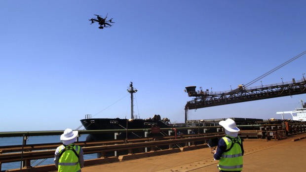
With mines, railways and ports sprawling over hundreds of kilometres, unmanned drones are increasingly being used by miners to check equipment, measure ore stockpiles and look after companies’ environmental obligations.

The growing use of drones in industrial settings will go under the microscope at a conference in Perth today, where mining companies and aviation regulators meet.

Rio Tinto’s technology and innovation executive Greg Lilleyman said his company had already started using drones to monitor and measure various aspects of its iron ore and coal businesses in Western Australia and Queensland respectively.

“Information will be the single biggest differentiating factor between the mining operations of the past and those in the future, and drones can produce a wealth of information to allow us to make better decisions,” he said.

When fitted with video or thermal imaging cameras, the drones can help companies to inspect machinery and other pieces of equipment much faster and cheaper than by using humans and helicopters.

“We’re already using drones to monitor our sites and inspect equipment, tasks that have traditionally presented safety risks for our people, taken up time and disrupted our operations,” said Mr Lilleyman

“Other innovative uses we are finding include tasks like monitoring remote turtle nesting sites and spraying weeds as part of our environmental programs.

“We see immense potential for drones to help extend the advantage Rio Tinto holds through the innovative use of technology, to improve the safety and productivity of our operations.”

Fortescue Metals Group looks set to adopt drones after a successful trial at the Cloudbreak iron ore mine last year, while BHP Billiton has also adopted them for stockpile measurement and other topographical surveys.
Read more: http://www.smh.com.au/business/mining-and-resources/from-amazoncom-to-iron-ore-mines-drones-are-on-the-rise-20150831-gjbeje.html#ixzz3kR28DTOl

Washington: Naches Heights fire official sees drone use as a tool to help firefighters

stevemack

After a suspicious brush fire in Naches Heights earlier this summer, Steven Mack decided to get a better look at the fire scene.

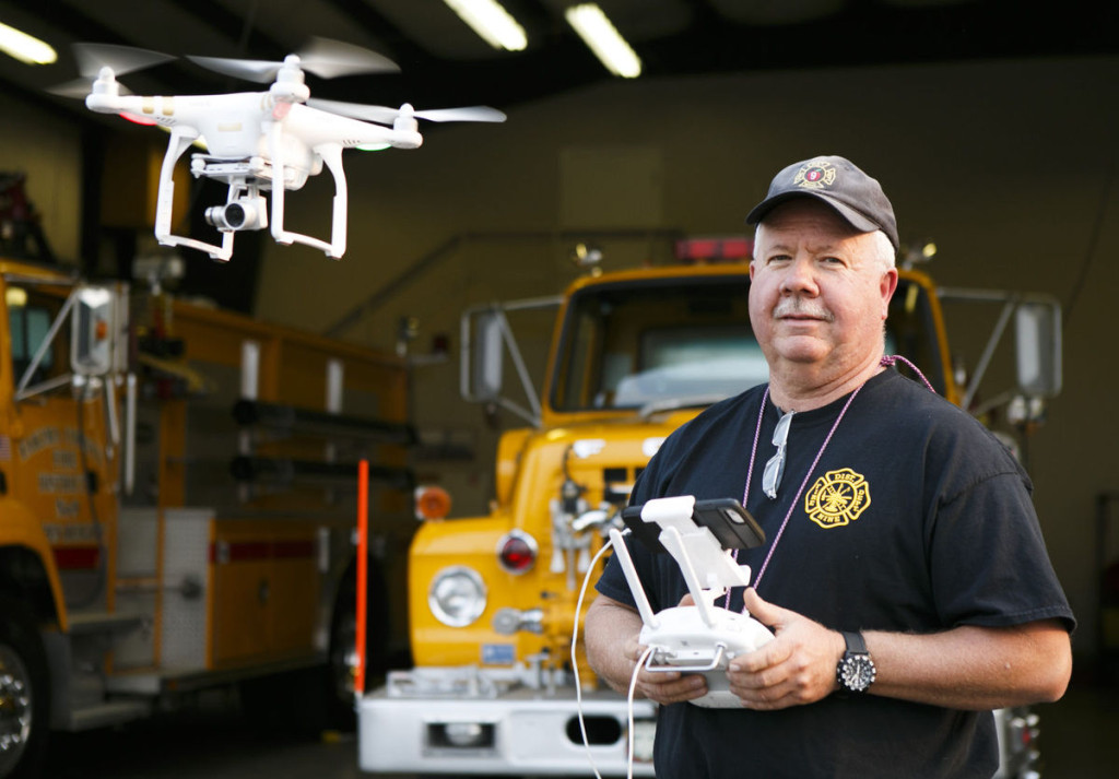
Rather than walk the charred earth or seek out higher ground to gain an overview, the Naches Heights Fire Department lieutenant used his DJI Phantom Vision 2 quadcopter to fly over the fire site and shoot video from different angles.

The video, he said, showed how the fire burned and offered possible clues to guide investigators to its origin.

Mack hopes the quadcopter gets used more often in firefighting and rescue operations.

“I see this as a toolbox,” he said.

Other fire officials think the aircraft, commonly called drones, have potential. But they don’t expect to see widespread deployment anytime soon due to cost and lack of uniform procedures for using them.

Battery-powered drones became popular about two years ago, said Mike Hanratty, owner of Mike’s Model Aircraft Supply and Hobby Center in Yakima.

Hanratty, a former president of the Yakima Valley Aeromodelers club, said the craft range from small copters that can fit in a person’s palm for less than $40, to quadcopters that can carry high-definition cameras and fly more than a mile from their operators that cost more than $1,000. The drone that Mack owns cost about $1,200.

Hobbyists use the craft to shoot pictures and video of landscapes, architecture and events. Mack, who got his drone a year ago, has shot aerial video of the entire length of Cowiche Canyon, as well as footage of a local vineyard. Hobbyists are not the only ones using them, either. Some farmers use drones to monitor fields and ensure that crops are getting enough water.

But drones have their detractors as well. There have been incidents of people shooting at quadcopters, claiming they were being spied on.

The National Park Service bans drones in parks and national monuments, saying the crafts have disturbed people and harassed wildlife.

At one California wildfire, crews suspended aerial operations because drones were at risk of colliding with air tankers and helicopters trying to quench flames. The incident prompted California lawmakers to draft a bill that would allow firefighters and emergency personnel to bring down drones during fire emergencies without fear of prosecution.

But Mack believes that, in the right hands, a drone can be an asset to firefighters. For limited personal use, such as what Mack does, no license or permit is required from the Federal Aviation Administration.

At the moment, he uses his drone to take photos and video after brush fires, allowing firefighters to survey the scene and get a better understanding of what happened. But there are other applications as well, Mack said.

For example, a fire commander could use a drone to get a bird’s-eye view of an entire brush fire to see how the flames are moving and how best to deploy firefighters. Mack said his drone can provide live views.

A drone would also be useful in situations where it’s too dangerous to send a firefighter, such as a train derailment involving hazardous materials.

“I can fly in and identify the (hazardous materials) placards on the train cars,” Mack said, allowing responders to know exactly what they are dealing with.

Drones could also aid search-and-rescue teams, allowing them to search rugged areas faster, Mack said. With GPS technology, the drone could pinpoint a lost or injured person’s precise location.

Mack said he’s been asked to do demonstrations, and has had officials with other agencies, such as the Yakima Fire Department, discuss the potential for drones.

Yakima fire Deputy Chief Ted Vander Houwen said he’s talked to Mack, and sees the benefits of the technology.

http://www.yakimaherald.com/news/local/naches-heights-fire-official-sees-drone-use-as-a-tool/article_c313ed34-5075-11e5-b02a-5b0ab9b55fa5.html