How Peru is using drones to protect its archaeological treasures.

Photo by Faine Greenwood
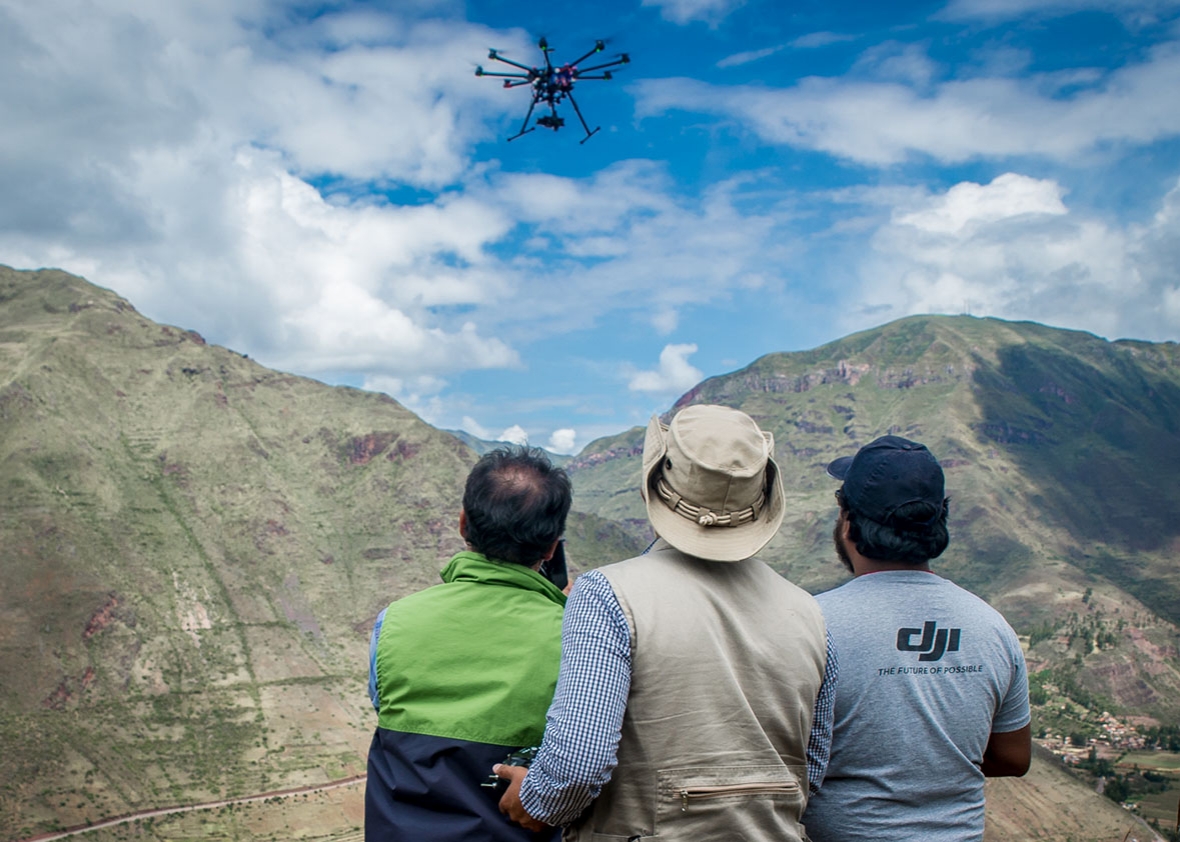
The eight-armed drone proceeds along the busy tourist road that leads up to the world-famous Machu Picchu archaeological site in Peru, floating just above the tropical forest that lines each side of the roadway. It’s piloted by Peruvian Ministry of Culture drone expert Aldo Watanave, who watches the device intently, his eyes occasionally darting to the little video screen that I’ve agreed to hold for him.
Another colleague is in control of the camera mounted to the drone’s underside, and he uses a remote control to snap a photo whenever Watanave tells him to. Just up the trail, a middle-aged French tourist with a walking stick comes into view, and he’s not happy to see the drone: He begins swearing profusely, as if we have personally violated him. “From the Ministry of Culture!” I shout back, attempting to gauge how crazy he is.
Drone archaeology is not without its occupational hazards, but for Watanave and his colleagues, the risks are more than worth it. With their drone mapping work, they’re demonstrating to archeologists and museums around the world how they can use aerial imagery to create inexpensive maps and 3-D models of humanity’s collective cultural heritage—virtual representations that may define the museums of the not-so-distant future.
Founded in 2013 by Luis Jaime Castillo Butters, the former deputy minister of cultural heritage and cultural industries, Peru’s drone archaeology team has quickly become one of the most active in the world, working to accurately survey and preserve the South American nation’s thousands of valuable archaeological sites. At the beginning, team members had no special engineering expertise or any prior experience with unmanned aerial vehicles, or UAVs. But in just two years, they have become an authority on this specific area of drone mapping, with archaeologists and drone pilots from around the world now reaching out to them for advice. “Anybody can do the work we do. Anybody can work with the drones, anybody can work with the software, anybody can produce the stuff we are producing,” Castillo explains. “We are simply doing it on a scale that is actually having a real impact on cultural patrimony.”
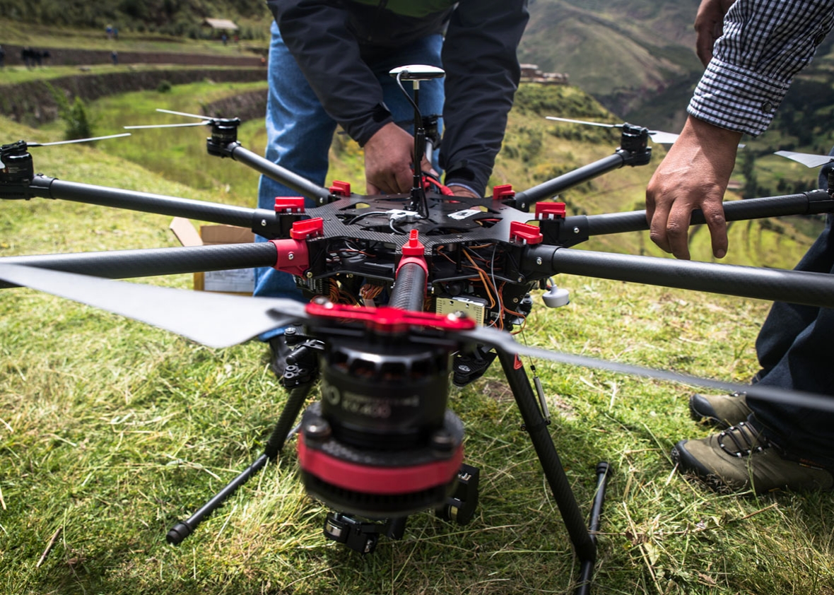
Since the program began, the Ministry of Culture’s drone team has mapped more than 600 sites, allowing it to create standardized records of archaeological data at a much faster pace than was possible in the days of ground-based surveying. The group has developed a relatively standardized process for its archaeological missions, primarily using Chinese drone maker DJI’s Spreading Wing S1000 “octocopters” for their mapping projects. The hefty drones are equipped with Sony NEX-7 mirrorless cameras and can stay in the air for roughly 15 minutes, but their battery life decreases when flying at a high altitude, as is often the case in Peru.
The drone team’s process begins with marking out at least three ground-control points in the area to be mapped, which can be identified from the sky with the assistance of a highly visible marker. Next, the archaeologists use a differential GPS unit to accurately survey (asses the location of) each point. The drone team assesses the weather—and also makes sure that any people on the ground are aware of what’s happening. When the all-clear is given, it’s time for liftoff.

Photo by Faine Greenwood
In simplest terms, aerial maps are made by combining hundreds of different photos—I wrote about this process in detail in New America’s new Drones and Aerial Observation primer. (New America is a partner with Slate and Arizona State in Future Tense.) To make sure the photos overlap enough, the drone has to fly in a specific pattern—it’s easy to think of this as the pattern a lawnmower makes as it traverses the lawn, with straight lines overlapping to ensure no spots are missed. Although many drone mappers program their devices to fly themselves in a predetermined pattern, Watanave is wary of automatic drone flight, thanks to the painful memory of a recent drone crash caused by a failed autopilot. Instead, the Peruvian pilots eyeball the pattern and fly it themselves at an altitude between 196 and 262 feet, shooting a photograph every 2 to 3 seconds.
Once shooting is over, it’s time for the archaeologists to use Agisoft Photoscan photogrammetry software to stitch the photographs together into a single image. The aerial maps and 3-D models that archaeologists use have to be geographically accurate—applicable to the real world and capable of being layered on top of pre-existing maps—so the software geometrically corrects (orthorectifies) the images so that they have a uniform scale.
The process may be relatively straightforward, but fieldwork has its own perils, from angry French tourists to technical error to simple poor luck. The $3,300 octocopters are relatively sturdy, but they’re definitely breakable. Not that this vulnerability stops the archaeologists: During my visit to Peru, I watched, impressed, as the team floated the drone (packed in a waterproof case) from the shore of an inflatable raft onto the rocky coast of an island somewhere off the coast near Lima. Two archaeologists walked the hefty box and its robotic cargo up the steep path to the top of the island they’d been sent to survey in punishing heat, as vultures watched their progress.
http://www.slate.com/articles/technology/future_tense/2015/08/how_peru_is_using_drones_to_protect_machu_picchu_and_other_archaeological.html
